
Cemetery #45726
Przytyk Jewish Cemetery
Local name: Przytyk, cmentarz żydowski
Also known as Cmentarz Żydowski w Przytyku
0
documented records
≈ 83–170
approx. capacity (graves)
4,170 m²
cemetery area
Oct 18, 2026
last modified
About this cemetery
The Jewish cemetery in Przytyk was founded in the second half of the 17th century. It covers about 0.2 hectares, and a gate was built in 1882. Roughly 30 richly decorated gravestones survive, including a double tombstone of the rabbis Samuel Zajnwel and his son. The cemetery served Jews from Przytyk and Radom and was used until the Przytyk Jews were deported in 1942.
Read more in our story: How to Read a Jewish Gravestone: A Guide to the Matzevah
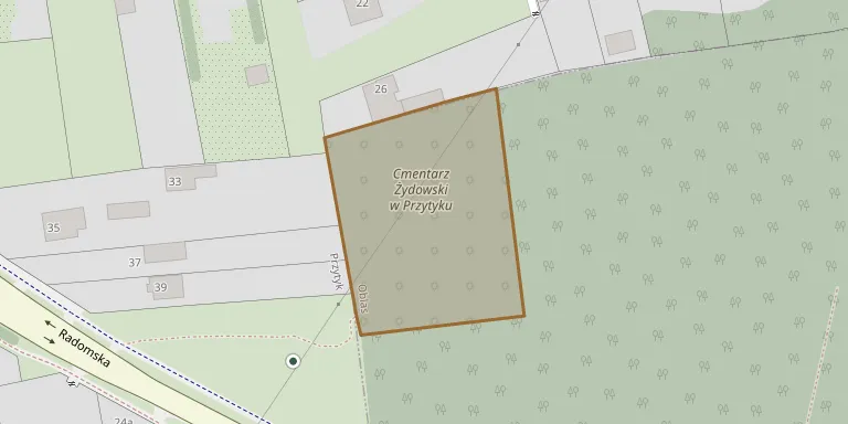
Cemetery location
GPS coordinates: 51.463265° N, 20.915793° E Directions in Google Maps (opens in a new tab)
Memorials
No records yet
Photograph a headstone and add it to the archive.
Looking for someone who isn't listed? Request a photo.
Nearby cemeteries
The closest other burial grounds listed on EveryStone.
- Przytyk Parish Cemetery 1.4 km away · Przytyk
- Jarosławice Parish Cemetery 4.8 km away · Jarosławice
- Wrzos Parish Cemetery 5.7 km away · Wrzos
- Zakrzew Parish Cemetery 5.8 km away · Zakrzew
- Tursk Cemetery 6.9 km away · Tursk
- Wrzeszczów Parish Cemetery 7.2 km away · Wrzeszczów
- Jankowice Parish Cemetery 7.9 km away · Jankowice · 3 records
- Radom Insurgents' War Cemetery 8.2 km away · Radom
- Stara Błotnica Parish Cemetery 10 km away · Stara Błotnica
- Wolanów Parish Cemetery 10 km away · Wolanów
Contribute with the app
Our website works smoothly on both desktop and mobile devices. Prefer a native app? Check it out below.
- Capture clear headstone photos
- Save GPS grave locations automatically
- Transcribe inscriptions with our AI
- Suggest corrections to existing records
Common questions
How big is Przytyk Jewish Cemetery?
Przytyk Jewish Cemetery covers about 4,170 m² (1 acre), about half the size of a soccer field. It is the 279th smallest of the 1,222 cemeteries we list in Masovian Voivodeship.