
0
documented records
≈ 91–180
approx. capacity (graves)
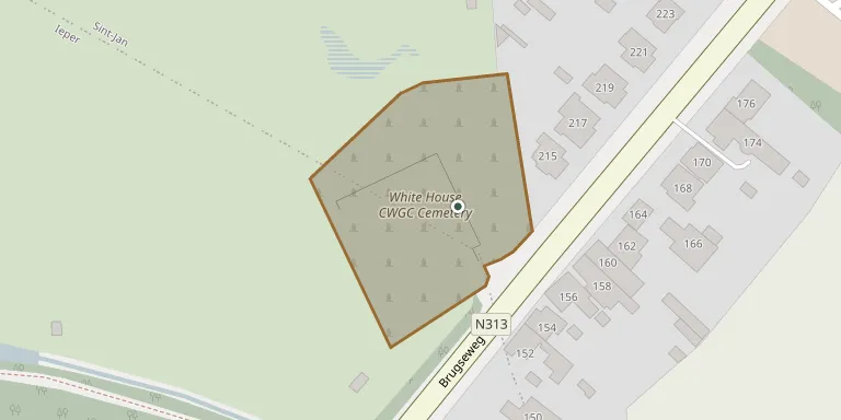
4,540 m²
cemetery area
Oct 18, 2026
last modified
About this cemetery
White House Cemetery at St Jean, near Ypres, was begun in March 1915 and used until April 1918 by units holding this part of the line. It takes its name from a White House that stood on the road from Ypres to St Jean. After the Armistice, Plots I and II were completed and Plots III and IV were added. The land was assigned to the United Kingdom in perpetuity by King Albert I of Belgium. The cemetery can be found online through ww1cemeteries.com.
Cemetery location
GPS coordinates: 50.861919° N, 2.899060° E Directions in Google Maps (opens in a new tab)
Memorials
No records yet
Photograph a headstone and add it to the archive.
Looking for someone who isn't listed? Request a photo.
Nearby cemeteries
The closest other burial grounds listed on EveryStone.
- La Brique Military Cemetery #01 420 m away · Ieper
- Sint-Jan Churchyard 450 m away · Ieper
- La Brique Military Cemetery #02 470 m away · Ieper
- Potijze Burial Ground Cemetery 800 m away · Potijze
- Ypres Town Cemetery Extension 900 m away · Ieper
- Ieper Municipal Cemetery 900 m away · Ieper
- Ypres Municipal Cemetery 930 m away · Ypres
- Potijze Chateau Wood Cemetery 990 m away · Ieper
- Potijze Chateau Lawn Cemetery 1.1 km away · Ieper
- Wieltje Farm Cemetery 1.1 km away · Ieper
Contribute with the app
Our website works smoothly on both desktop and mobile devices. Prefer a native app? Check it out below.
- Capture clear headstone photos
- Save GPS grave locations automatically
- Transcribe inscriptions with our AI
- Suggest corrections to existing records
Common questions
How big is White House Cemetery?
White House Cemetery covers about 4,540 m² (1.1 acres), about half the size of a soccer field. It is the 214th largest of the 503 cemeteries we list in West Flanders.