
Cemetery #7128
Horten Cemetery
Local name: Horten kapell og kirkegård
Also known as Horten kirkegård
0
documented records
≈ 820–1,600
approx. capacity (graves)
0.041 km²
cemetery area
Oct 18, 2026
last modified
About this cemetery
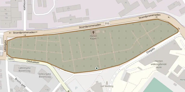
Horten church and cemetery lie on Bekkegata, just outside the Karljohansvern naval area. The ground belonged to the armed forces, which ran the cemetery until 1955, and local history sources date the churchyard to the mid-1800s. The cemetery chapel was built in 1939-1940 to designs by the Oslo architect Carl Berner, and today the grounds are administered by Horten kirkelige fellesråd.
Cemetery location
GPS coordinates: 59.420361° N, 10.484068° E Directions in Google Maps (opens in a new tab)
Memorials
No records yet
Photograph a headstone and add it to the archive.
Looking for someone who isn't listed? Request a photo.
Nearby cemeteries
The closest other burial grounds listed on EveryStone.
- Borre New Cemetery 4.4 km away · Horten · 38 records
- Nykirke Churchyard 5.7 km away · Horten
- Undrumsdal Kirke 8.5 km away · Re · 40 records
- Jeløy Cemetery 9.0 km away · Moss
- Moss Churchyard 10 km away · Moss · 28 records
- Bilet kapell 11 km away · Holmestrand
- Våle Cemetery 12 km away · Våle
- Den Hellige Ånds Kirke 12 km away · Holmestrand
- Slagen Cemetery 13 km away · Tønsberg · 149 records
- Botne Cemetery 14 km away · Holmestrand · 92 records
Contribute with the app
Our website works smoothly on both desktop and mobile devices. Prefer a native app? Check it out below.
- Capture clear headstone photos
- Save GPS grave locations automatically
- Transcribe inscriptions with our AI
- Suggest corrections to existing records
Common questions
How big is Horten Cemetery?
Horten Cemetery covers about 41,000 m² (10 acres), about the size of 6 soccer fields. It is the 8th largest of the 53 cemeteries we list in Østfold.