
Østfold
53 known cemeteries in Østfold, Norway.
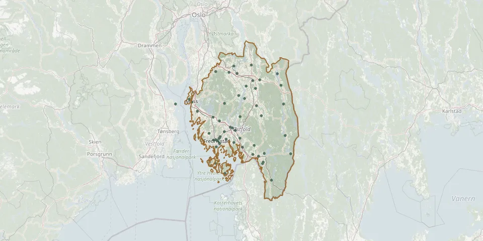 © OpenStreetMap
- Øymark ChurchyardGPS coordinates: 59.41970° N, 11.66380° E
- Moss ChurchyardGPS coordinates: 59.42990° N, 10.66280° E
- Askim Chapel and ChurchyardGPS coordinates: 59.58969° N, 11.15571° E
- Trøgstad kirkeGPS coordinates: 59.63648° N, 11.31271° E
- Idd ChurchyardGPS coordinates: 59.08629° N, 11.43467° E
- Råde ChurchyardGPS coordinates: 59.34650° N, 10.89450° E
- Fredrikstad East CemeteryGPS coordinates: 59.20279° N, 10.96179° E
- Aremark CemeteryGPS coordinates: 59.24437° N, 11.68204° E
- Asak ChurchyardGPS coordinates: 59.14409° N, 11.45415° E
- Berg CemeteryGPS coordinates: 59.13817° N, 11.32936° E
- Borge CemeteryGPS coordinates: 59.22378° N, 11.03673° E
- Degernes CemeteryGPS coordinates: 59.35470° N, 11.42299° E
- Dypedal CemeteryGPS coordinates: 59.08817° N, 10.91848° E
- Eidsberg KirkeGPS coordinates: 59.51992° N, 11.25627° E
- Ek CemeteryGPS coordinates: 59.25637° N, 10.85047° E
- Fredrikstad War CemeteryGPS coordinates: 59.19876° N, 10.96680° E
- Fredrikstad West CemeteryGPS coordinates: 59.22129° N, 10.92447° E
- Giltvet CemeteryGPS coordinates: 59.59551° N, 11.06796° E
- Glemmen ChurchyardGPS coordinates: 59.21568° N, 10.93878° E
- Glemmen Old ChurchyardGPS coordinates: 59.23767° N, 10.97118° E
- Gressvik ChurchyardGPS coordinates: 59.21880° N, 10.89776° E
- Hærland CemeteryGPS coordinates: 59.55347° N, 11.40431° E
- Hafslund CemeteryGPS coordinates: 59.27264° N, 11.13913° E
- Hobøl ChurchyardGPS coordinates: 59.60041° N, 10.92351° E
- Holmegil CemeteryGPS coordinates: 59.14251° N, 11.74169° E
- Horten CemeteryGPS coordinates: 59.42036° N, 10.48407° E
- Hovin CemeteryGPS coordinates: 59.63077° N, 11.12175° E
- Ingedal CemeteryGPS coordinates: 59.17845° N, 11.21533° E
- Jeløy CemeteryGPS coordinates: 59.44734° N, 10.63478° E
- Kirkegrenda CemeteryGPS coordinates: 59.37856° N, 10.72254° E