
0
documented records
≈ 1,000–2,000
approx. capacity (graves)
0.051 km²
cemetery area
Oct 18, 2026
last modified
About this cemetery
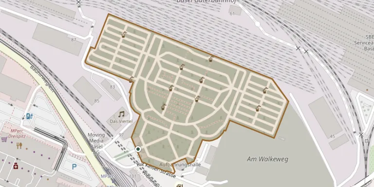
The Wolfgottesacker is one of Basel's cemeteries, named after the field name Wolffeld, and opened in 1872. It lies in the east of the city beside the SBB railway tracks, in the Dreispitz commercial area. In 1951 to 1953 numerous graves from the Horburg and Kannenfeld cemeteries, which were being closed, were relocated here. The city gardening department maintains it together with the Hoernli cemetery. More about the cemetery can be found through bs.ch.
Cemetery location
GPS coordinates: 47.539367° N, 7.607180° E Directions in Google Maps (opens in a new tab)
Memorials
No records yet
Photograph a headstone and add it to the archive.
Looking for someone who isn't listed? Request a photo.
Nearby cemeteries
The closest other burial grounds listed on EveryStone.
- Basel-Sankt Margarethen Cemetery 2.1 km away · Binningen
- St. Margarethen Cemetery (North), Basel 2.1 km away · Basel
- Birsfelden Cemetery 2.3 km away · Birsfelden
- Schönenberg Cemetery (Bottmingen) 2.9 km away · Bottmingen
- Münchenstein Urn Hall 3.0 km away · Münchenstein
- Münchenstein Cemetery 3.1 km away · Münchenstein
- Muttenz Cemetery 3.6 km away · Muttenz
- Hörnli Cemetery 3.8 km away · Riehen
- Muslimengräber 4.1 km away · Riehen
- Grenzach Cemetery 4.3 km away · Grenzach-Wyhlen
Contribute with the app
Our website works smoothly on both desktop and mobile devices. Prefer a native app? Check it out below.
- Capture clear headstone photos
- Save GPS grave locations automatically
- Transcribe inscriptions with our AI
- Suggest corrections to existing records
Common questions
How big is Wolfgottesacker Cemetery, Basel?
Wolfgottesacker Cemetery, Basel covers about 51,000 m² (13 acres), about the size of 7 soccer fields. It is the largest of the 56 cemeteries we list in Basel-Landschaft.