
Cemetery #7887
Stow-on-the-Wold Cemetery
39
documented records
≈ 290–580
approx. capacity (graves)
0.015 km²
cemetery area
Nov 5, 2026
last modified
About this cemetery
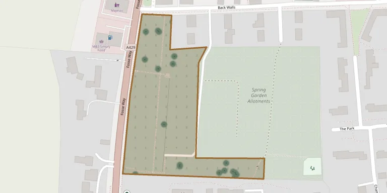
Stow on the Wold Town Council is the burial authority for the parishes of Stow on the Wold and Maugersbury, and its cemetery has its main entrance from the A429.
Cemetery location
GPS: GPS coordinates: 51.926411° N, 1.725467° W Directions in Google Maps (opens in a new tab)
Memorials
39 memorials, A–Z by surname.
 Sheena Anderson 1948 – 2005
 Cecilia Ashton 1927 – 2016
- Samuel Ashton 1918 – 2009
 Sarah Booy 1833 – 1876
 Mary Buffery 1881 – 1988
- William Buffery ? – 1908
 Arthur Carne 1888 – 1946
- Edith Carne 1895 – 1992
 Elizabeth Clifford 1815 – 1880
- Gilbert Clifford 1905 – 1957
- Robert Clifford 1852 – 1903
- Violet Clifford 1904 – 1929
 Win Foley 1912 – 1999
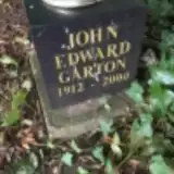 John Garton 1912 – 2000
- Ann Gregory 1819 – 1881
 Pamela Hawtin 1930 – 1995
 Raymond Heath 1919 – 1998
 Ethal Hellman 1922 – 1997
 Elizabeth Howman 1828 – 1901
- John Howman 1827 – 1909
 Florence Hyde 1878 – 1961
 Evelyn Lake 1907 – 1975
 Thyra Llewellyn 1924 – 2004
- Urias Llewellyn 1919 – 2004
 Maureen Naylor 1939 – 2020
 Colette Oakey 1964 – 2018
- Richard Oakey 1944 – 2013
- Timothy Oakey 1949 – 1998
 Annie Reynolds 1881 – 1956
- Edith Reynolds 1886 – 1946
 Alan Rofe 1920 – 1998
- Albert Rofe 1884 – 1960
- Betsy Sheppard 1837 – 1911
 Joyce Stephens 1921 – 2014
 Gertrude Taylor 1898 – 1970
- Reginald Taylor 1898 – 1959
 Abram Whitby 1961 – 1974
- Anne Whitby 1933 – 2020
- Peter Whitby 1932 – 1973
Looking for someone who isn't listed? Request a photo.
Nearby cemeteries
The closest other burial grounds listed on EveryStone.
- St. Edward Churchyard 410 m away · Stow on the Wold · 2 records
- St Mary's Church 1.6 km away · Stow on the Wold
- Broadwell St Paul Churchyard 2.6 km away · Broadwell
- St. Mary's Churchyard 3.6 km away · Lower Slaughter · 1 record
- St. Mary the Virgin Churchyard 3.6 km away · Icomb
- St. Laurence Churchyard 3.9 km away · Wyck Rissington
- The Parish Church of St. Peter 4.1 km away · Upper Slaughter · 2 records
- St James Churchyard 4.5 km away · Longborough
- St Nicholas Churchyard Oddington 4.5 km away · Oddington
- Cemetery near Cheltenham 4.8 km away · Cheltenham
Contribute with the app
Our website works smoothly on both desktop and mobile devices. Prefer a native app? Check it out below.
- Capture clear headstone photos
- Save GPS grave locations automatically
- Transcribe inscriptions with our AI
- Suggest corrections to existing records
Common questions
How big is Stow-on-the-Wold Cemetery?
Stow-on-the-Wold Cemetery covers about 15,000 m² (3.6 acres), about the size of 2 soccer fields. It is the 25th largest of the 385 cemeteries we list in Gloucestershire.
What is the oldest grave in this cemetery?
The oldest grave among the records we hold for Stow-on-the-Wold Cemetery is that of Sarah Booy, who died on November 8, 1876 at the age of 43.