
Gloucestershire
385 known cemeteries in Gloucestershire, United Kingdom.
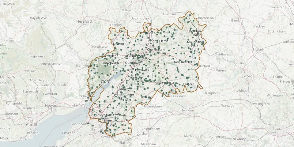 © OpenStreetMap
- Stow-on-the-Wold CemeteryGPS coordinates: 51.92641° N, 1.72547° W
- Mangotsfield CemeteryGPS coordinates: 51.49146° N, 2.49625° W
- Shirehampton CemeteryGPS coordinates: 51.48953° N, 2.67971° W
- Cheltenham Cemetery and CrematoriumGPS coordinates: 51.90647° N, 2.04254° W
- St James ChurchyardGPS coordinates: 52.05327° N, 1.77588° W
- Downend Christ ChurchyardGPS coordinates: 51.48615° N, 2.50755° W
- St. Mary Magdalene's ChurchyardGPS coordinates: 52.02308° N, 2.15618° W
- Stoke Gifford (Saint Michael) ChurchyardGPS coordinates: 51.51500° N, 2.54520° W
- Fairford, St Mary the Virgin ChurchyardGPS coordinates: 51.70885° N, 1.78146° W
- Berkeley CemeteryGPS coordinates: 51.69468° N, 2.46016° W
- St James the Great Church, WesterleighGPS coordinates: 51.51495° N, 2.43420° W
- St. Peter ChurchyardGPS coordinates: 51.95251° N, 1.96796° W
- Westerleigh Cemetery and CrematoriumGPS coordinates: 51.50527° N, 2.42904° W
- Cirencester Parish CemeteryGPS coordinates: 51.71775° N, 1.96657° W
- Littledean (Saint Ethelbert) ChurchyardGPS coordinates: 51.81966° N, 2.47705° W
- North Nibley CemeteryGPS coordinates: 51.65865° N, 2.37716° W
- St. Mary Redcliffe CemeteryGPS coordinates: 51.44284° N, 2.56462° W
- St Mary's ChurchyardGPS coordinates: 51.91439° N, 2.04511° W
- Wotton Baptist ChurchyardGPS coordinates: 51.63718° N, 2.35319° W
- Ashchurch (Saint Nicholas) ChurchyardGPS coordinates: 51.99925° N, 2.10678° W
- Pucklechurch (Saint Thomas a Becket) ChurchyardGPS coordinates: 51.48689° N, 2.43458° W
- St. Peter's ChurchyardGPS coordinates: 51.87804° N, 1.72626° W
- All Saints ChurchyardGPS coordinates: 51.87569° N, 2.45970° W
- Holy Trinity ChurchyardGPS coordinates: 51.70636° N, 2.18607° W
- Standish (Saint Nicholas) ChurchyardGPS coordinates: 51.77420° N, 2.29024° W
- St Catharine's Cemetery, Chipping CampdenGPS coordinates: 52.04994° N, 1.78553° W
- St Peter Church, MathernGPS coordinates: 51.61165° N, 2.70199° W
- Miserden St Andrews ChurchyardGPS coordinates: 51.77875° N, 2.09405° W
- St Mary Magdalene Church, BoddingtonGPS coordinates: 51.92494° N, 2.15555° W
- St Michael & All Angels ChurchGPS coordinates: 51.94762° N, 2.05948° W