
Burgenland
341 known cemeteries in Burgenland, Austria.
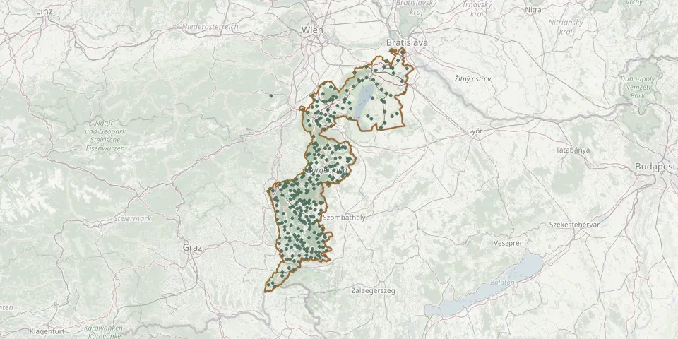 © OpenStreetMap
- Kroatisch Tschantschendorf CemeteryGPS coordinates: 47.10031° N, 16.28490° E
- Kroisegg CemeteryGPS coordinates: 47.37725° N, 16.03761° E
- Krottendorf bei Güssing CemeteryGPS coordinates: 47.06135° N, 16.30681° E
- Kukmirn CemeteryGPS coordinates: 47.07044° N, 16.20602° E
- Kulm im Burgenland CemeteryGPS coordinates: 47.10247° N, 16.45317° E
- Lackenbach CemeteryGPS coordinates: 47.59284° N, 16.47048° E
- Lackenbach Jewish CemeteryGPS coordinates: 47.59210° N, 16.46826° E
- Lackendorf CemeteryGPS coordinates: 47.59182° N, 16.50459° E
- Landsee CemeteryGPS coordinates: 47.55541° N, 16.32891° E
- Langeck CemeteryGPS coordinates: 47.40196° N, 16.37828° E
- Langental CemeteryGPS coordinates: 47.50094° N, 16.54547° E
- Lebenbrunn CemeteryGPS coordinates: 47.46026° N, 16.30325° E
- Liebing CemeteryGPS coordinates: 47.41402° N, 16.49098° E
- Limbach CemeteryGPS coordinates: 47.06189° N, 16.16909° E
- Lindgraben CemeteryGPS coordinates: 47.57638° N, 16.40179° E
- Litzelsdorf CemeteryGPS coordinates: 47.20716° N, 16.16311° E
- Lockenhaus CemeteryGPS coordinates: 47.40496° N, 16.41513° E
- Loipersbach im Burgenland CemeteryGPS coordinates: 47.69300° N, 16.46542° E
- Loipersdorf CemeteryGPS coordinates: 47.33288° N, 16.08800° E
- Loretto CemeteryGPS coordinates: 47.91319° N, 16.51353° E
- Mannersdorf an der Rabnitz CemeteryGPS coordinates: 47.42888° N, 16.52445° E
- Maria Bild CemeteryGPS coordinates: 46.95969° N, 16.18894° E
- Mariasdorf CemeteryGPS coordinates: 47.36878° N, 16.23050° E
- Markt Allhau CemeteryGPS coordinates: 47.29219° N, 16.09377° E
- Markt Neuhodis ChurchyardGPS coordinates: 47.29609° N, 16.39708° E
- Markt Neuhodis New CemeteryGPS coordinates: 47.29392° N, 16.39769° E
- Markt Sankt Martin CemeteryGPS coordinates: 47.55786° N, 16.41823° E
- Marz CemeteryGPS coordinates: 47.71872° N, 16.41600° E
- Mattersburg CemeteryGPS coordinates: 47.73605° N, 16.40349° E
- Mattersburg Jewish CemeteryGPS coordinates: 47.73774° N, 16.40279° E