
Lower Austria
1,114 known cemeteries in Lower Austria, Austria.
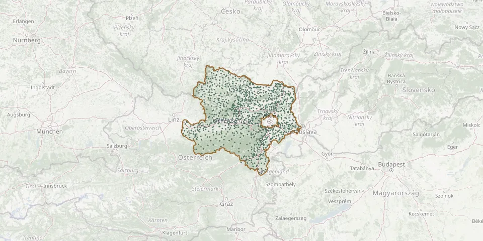 © OpenStreetMap
- Stössing CemeteryGPS coordinates: 48.12603° N, 15.81111° E
- NappersdorfGPS coordinates: 48.62952° N, 16.18932° E
- Roseldorf CemeteryGPS coordinates: 48.64252° N, 15.92639° E
- Lehenrotte CemeteryGPS coordinates: 47.95640° N, 15.54947° E
- Mühlleiten CemeteryGPS coordinates: 48.17581° N, 16.56441° E
- Murstetten CemeteryGPS coordinates: 48.23678° N, 15.83011° E
- Mödling CemeteryGPS coordinates: 48.07211° N, 16.29739° E
- Spratzern CemeteryGPS coordinates: 48.16622° N, 15.62317° E
- Böheimkirchen CemeteryGPS coordinates: 48.19705° N, 15.76230° E
- Gerersdorf CemeteryGPS coordinates: 48.19861° N, 15.55608° E
- Neuaigen CemeteryGPS coordinates: 48.36829° N, 16.02503° E
- Schwarzenbach an der Pielach CemeteryGPS coordinates: 47.94638° N, 15.38168° E
- Brand-Laaben CemeteryGPS coordinates: 48.11034° N, 15.86692° E
- Mailberg CemeteryGPS coordinates: 48.67344° N, 16.18441° E
- Bad Großpeterholz CemeteryGPS coordinates: 48.62673° N, 14.83002° E
- Sittendorf CemeteryGPS coordinates: 48.07525° N, 16.16569° E
- Josefsberg CemeteryGPS coordinates: 47.84533° N, 15.31360° E
- Sierndorf CemeteryGPS coordinates: 48.42755° N, 16.16738° E
- Vienna War Graves of World War II (Group 97)GPS coordinates: 48.14240° N, 16.43631° E
- Kogl CemeteryGPS coordinates: 48.22604° N, 15.99062° E
- Sankt Gotthard CemeteryGPS coordinates: 48.03587° N, 15.33049° E
- Gösing am WagramGPS coordinates: 48.46771° N, 15.81435° E
- Gutenbrunn CemeteryGPS coordinates: 48.36690° N, 15.12349° E
- Judenau CemeteryGPS coordinates: 48.28623° N, 16.00919° E
- St. Martin Im Walde CemeteryGPS coordinates: 48.66442° N, 14.83916° E
- Traismauer CemeteryGPS coordinates: 48.35198° N, 15.74461° E
- Wilfersdorf CemeteryGPS coordinates: 48.59074° N, 16.64423° E
- Wald Cemetery, PyhraGPS coordinates: 48.12763° N, 15.69714° E
- Gartenstadt Maria TheresiaGPS coordinates: 47.87250° N, 16.26060° E
- Wolkersdorf CemeteryGPS coordinates: 48.38466° N, 16.52301° E