
Lower Austria
1,114 known cemeteries in Lower Austria, Austria.
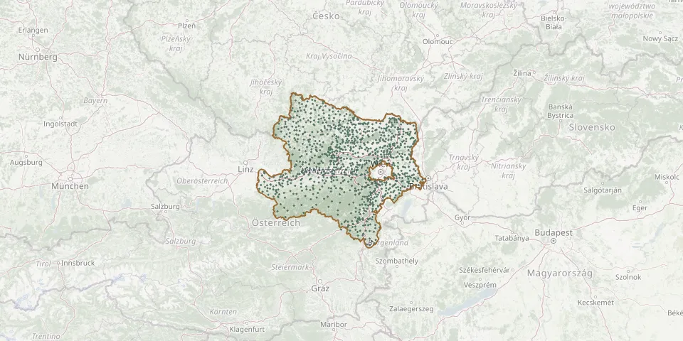 © OpenStreetMap
- St. John the Baptist Catholic Filial Churchyard, MaigenGPS coordinates: 48.67739° N, 15.77118° E
- St. John the Baptist Catholic Parish Churchyard, GrossheinrichschlagGPS coordinates: 48.42417° N, 15.38406° E
- St. Kunigunde Churchyard with Ossuary, DürnsteinGPS coordinates: 48.39454° N, 15.52126° E
- St. Lawrence Catholic Filial Churchyard, AllentsgschwendtGPS coordinates: 48.49897° N, 15.34149° E
- St. Lawrence Catholic Parish Churchyard, Dietmannsdorf an der WildGPS coordinates: 48.71257° N, 15.47366° E
- St. Lawrence Meadow Cemetery, Klein-EngersdorfGPS coordinates: 48.33146° N, 16.39033° E
- St. Leonard Catholic Parish Churchyard, Sankt Leonhard am WaldGPS coordinates: 47.99498° N, 14.87446° E
- St. Leonard Catholic Parish Churchyard, WolfshoferamtGPS coordinates: 48.59872° N, 15.54758° E
- St. Leonhard am Forst CemeteryGPS coordinates: 48.14143° N, 15.28943° E
- St. Lorenzen am Steinfeld CemeteryGPS coordinates: 47.74111° N, 16.03586° E
- St. Michael Catholic Parish Churchyard, HaunoldsteinGPS coordinates: 48.20151° N, 15.45229° E
- St. Michael CemeteryGPS coordinates: 48.37169° N, 15.43897° E
- St. Michael Cemetery, Seitzersdorf-WolfpassingGPS coordinates: 48.39830° N, 16.09467° E
- St. Michael (Jahrings)GPS coordinates: 48.58826° N, 15.09775° E
- St. Nicholas Catholic Filial Churchyard, PrigglitzGPS coordinates: 47.70275° N, 15.92824° E
- St. Nicholas Catholic Parish Churchyard, Plank am KampGPS coordinates: 48.55555° N, 15.68219° E
- Stockerau CemeteryGPS coordinates: 48.39834° N, 16.20834° E
- Stockerau Jewish CemeteryGPS coordinates: 48.39898° N, 16.20917° E
- Stockerau Monastery CemeteryGPS coordinates: 48.38486° N, 16.18777° E
- Stockern Christian CemeteryGPS coordinates: 48.64977° N, 15.72857° E
- Stoitzendorf CemeteryGPS coordinates: 48.65008° N, 15.86933° E
- Stollhofen CemeteryGPS coordinates: 48.35628° N, 15.76236° E
- St. Oswald CemeteryGPS coordinates: 48.26755° N, 15.03983° E
- St. Pancras Catholic Filial Churchyard, KuffernGPS coordinates: 48.32493° N, 15.64902° E
- St. Pankraz (Großglobnitz)GPS coordinates: 48.67300° N, 15.17090° E
- St. Peter/ Au CemeteryGPS coordinates: 48.04366° N, 14.62220° E
- St. Peter Catholic Parish Churchyard, Sankt Peter am WechselGPS coordinates: 47.55087° N, 16.01671° E
- St. Pölten Congregatio Jesu Monastery CemeteryGPS coordinates: 48.19212° N, 15.63781° E
- St. Radegundis Churchyard, PeigartenGPS coordinates: 48.70623° N, 16.03912° E
- Straning CemeteryGPS coordinates: 48.61421° N, 15.86515° E