
Antwerp
273 known cemeteries in Antwerp, Belgium.
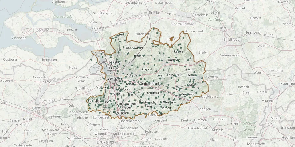 © OpenStreetMap
- Kapellen Municipal CemeteryGPS coordinates: 51.32652° N, 4.44385° E
- Wijnegem CemeteryGPS coordinates: 51.22940° N, 4.52570° E
- Walem ChurchyardGPS coordinates: 51.06630° N, 4.45827° E
- Berchem Communal CemeteryGPS coordinates: 51.18298° N, 4.42365° E
- Bazel ChurchyardGPS coordinates: 51.15255° N, 4.30255° E
- Ekeren CemeteryGPS coordinates: 51.28782° N, 4.42497° E
- Merksem Van Heybeeckstraat CemeteryGPS coordinates: 51.24850° N, 4.44922° E
- Willebroek Communal CemeteryGPS coordinates: 51.05893° N, 4.34486° E
- Aartselaar CemeteryGPS coordinates: 51.13438° N, 4.39300° E
- Achterbos CemeteryGPS coordinates: 51.20220° N, 5.09450° E
- Achterbroek CemeteryGPS coordinates: 51.39640° N, 4.50306° E
- Antwerpen Schoonselhof Communal CemeteryGPS coordinates: 51.16827° N, 4.36318° E
- Arendonk Centre CemeteryGPS coordinates: 51.32291° N, 5.08122° E
- Baarle-Hertog CemeteryGPS coordinates: 51.44064° N, 4.93289° E
- Balen Communal CemeteryGPS coordinates: 51.16545° N, 5.17496° E
- Balen SchoorheideGPS coordinates: 51.14450° N, 5.21470° E
- Beerse Beekakkersstraat CemeteryGPS coordinates: 51.32231° N, 4.84650° E
- Beerse hoevestraatGPS coordinates: 51.32250° N, 4.82380° E
- Beerzel CemeteryGPS coordinates: 51.05987° N, 4.66795° E
- Begraafpark NazarethGPS coordinates: 51.33809° N, 4.91179° E
- Begraafplaat RochusGPS coordinates: 51.20490° N, 4.46590° E
- Bel CemeteryGPS coordinates: 51.15985° N, 5.06309° E
- Bel Church CemeteryGPS coordinates: 51.16262° N, 5.06389° E
- Berendrecht Communal CemeteryGPS coordinates: 51.34042° N, 4.31557° E
- Bergom CemeteryGPS coordinates: 51.07694° N, 4.92041° E
- Berlaar CemeteryGPS coordinates: 51.11643° N, 4.66167° E
- Berlaar-Heikant CemeteryGPS coordinates: 51.08317° N, 4.66269° E
- Berlaar Hemelshoek CemeteryGPS coordinates: 51.09540° N, 4.64930° E
- Bevel CemeteryGPS coordinates: 51.13420° N, 4.68346° E
- Blaasveld CemeteryGPS coordinates: 51.05625° N, 4.37254° E