
Antwerp
273 known cemeteries in Antwerp, Belgium.
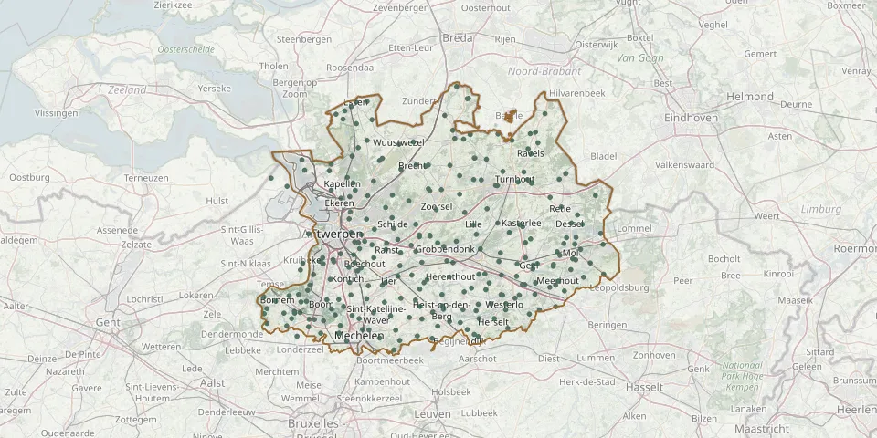 © OpenStreetMap
- Blauberg CemeteryGPS coordinates: 51.04222° N, 4.92646° E
- Boechout CemeteryGPS coordinates: 51.15584° N, 4.48473° E
- Bonheiden CemeteryGPS coordinates: 51.02346° N, 4.54100° E
- Booischot CemeteryGPS coordinates: 51.05307° N, 4.78374° E
- Boom CemeteryGPS coordinates: 51.09613° N, 4.38286° E
- Borgerhout SilsburgGPS coordinates: 51.20444° N, 4.47723° E
- Bornem CemeteryGPS coordinates: 51.09291° N, 4.22898° E
- Borsbeek CemeteryGPS coordinates: 51.19275° N, 4.48030° E
- Bouwel ChurchyardGPS coordinates: 51.16950° N, 4.74340° E
- Brans CemeteryGPS coordinates: 51.07949° N, 4.20230° E
- Brasschaat Centrum Communal CemeteryGPS coordinates: 51.29215° N, 4.50556° E
- Brasschaat Mariaburg CemeteryGPS coordinates: 51.29056° N, 4.45127° E
- Brasschaat Rustoord CemeteryGPS coordinates: 51.30268° N, 4.46738° E
- Brecht-centrum CemeteryGPS coordinates: 51.35044° N, 4.65063° E
- Broechem CemeteryGPS coordinates: 51.18515° N, 4.60422° E
- Cantincrode CemeteryGPS coordinates: 51.18100° N, 4.46282° E
- Church of St. Lambert Churchyard, EikevlietGPS coordinates: 51.09210° N, 4.30500° E
- Dessel Boshoek CemeteryGPS coordinates: 51.25631° N, 5.13619° E
- Dessel Centre CemeteryGPS coordinates: 51.24054° N, 5.11775° E
- Deurne Ruggeveld CemeteryGPS coordinates: 51.21920° N, 4.48572° E
- De Vrij CemeteryGPS coordinates: 51.33373° N, 5.10085° E
- Duffel CemeteryGPS coordinates: 51.09802° N, 4.50270° E
- Duffel Mijlstraat ChurchyardGPS coordinates: 51.09160° N, 4.55560° E
- Edegem CemeteryGPS coordinates: 51.15759° N, 4.44888° E
- Eindhout CemeteryGPS coordinates: 51.10628° N, 5.00783° E
- Elzestraat Hogevelden CemeteryGPS coordinates: 51.06055° N, 4.47967° E
- Emblem CemeteryGPS coordinates: 51.16050° N, 4.60280° E
- Essen Centre CemeteryGPS coordinates: 51.46823° N, 4.47040° E
- Essen Horendonk Communal CemeteryGPS coordinates: 51.46949° N, 4.50391° E
- Essen Statie CemeteryGPS coordinates: 51.45964° N, 4.45602° E