
Antwerp
273 known cemeteries in Antwerp, Belgium.
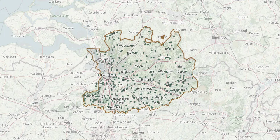 © OpenStreetMap
- Puurs Kerkhofstraat CemeteryGPS coordinates: 51.07448° N, 4.28451° E
- Ramsel CemeteryGPS coordinates: 51.03051° N, 4.82550° E
- Ramsel Old CemeteryGPS coordinates: 51.02616° N, 4.83727° E
- Ranst CemeteryGPS coordinates: 51.19060° N, 4.55995° E
- Ranst New Churchyard, SchawijkstraatGPS coordinates: 51.20290° N, 4.56200° E
- Rauw CemeteryGPS coordinates: 51.22110° N, 5.20580° E
- Ravels CemeteryGPS coordinates: 51.38009° N, 4.98755° E
- Ravels-Eel ChurchyardGPS coordinates: 51.39180° N, 5.01670° E
- Ravels St. Servatius CemeteryGPS coordinates: 51.37084° N, 4.99573° E
- Reet CemeteryGPS coordinates: 51.09686° N, 4.41801° E
- Retie CemeteryGPS coordinates: 51.27121° N, 5.08754° E
- Rijkevorsel ChurchyardGPS coordinates: 51.34974° N, 4.75238° E
- Rijmenam CemeteryGPS coordinates: 51.00091° N, 4.58368° E
- Rijmenam CemeteryGPS coordinates: 51.01891° N, 4.60102° E
- Rijweg CemeteryGPS coordinates: 51.05919° N, 4.32946° E
- Rosselaar CemeteryGPS coordinates: 51.17150° N, 5.13090° E
- Ruisbroek CemeteryGPS coordinates: 51.09306° N, 4.32101° E
- Rumst CemeteryGPS coordinates: 51.08353° N, 4.43261° E
- Schelle CemeteryGPS coordinates: 51.12382° N, 4.33179° E
- Scheutists' Cemetery, SchildeGPS coordinates: 51.25090° N, 4.57870° E
- Schilde CemeteryGPS coordinates: 51.23104° N, 4.58340° E
- Schoonbroek Cemetery (Retie)GPS coordinates: 51.28940° N, 5.05354° E
- Schoonselhof Cemetery, Commonwealth PlotsGPS coordinates: 51.16398° N, 4.37111° E
- Schoonselhof Large Military CemeteryGPS coordinates: 51.16381° N, 4.37152° E
- Schoten CemeteryGPS coordinates: 51.24826° N, 4.50181° E
- Schriek CemeteryGPS coordinates: 51.02306° N, 4.69895° E
- 's-Gravenwezel Municipal Cemetery, MoerstraatGPS coordinates: 51.26980° N, 4.55936° E
- Sint-Amands CemeteryGPS coordinates: 51.05094° N, 4.20192° E
- Sint-Amelbergakerk ChurchyardGPS coordinates: 51.21500° N, 4.66070° E
- Sint-Antonius CemeteryGPS coordinates: 51.28260° N, 4.62920° E