
Limburg
316 known cemeteries in Limburg, Belgium.
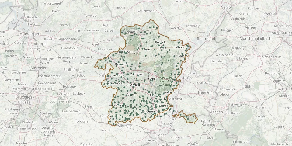 © OpenStreetMap
- Kuringen CemeteryGPS coordinates: 50.94539° N, 5.30430° E
- Tongeren Centre CemeteryGPS coordinates: 50.78687° N, 5.46487° E
- Houthalen CemeteryGPS coordinates: 51.03604° N, 5.38792° E
- Kermt ChurchyardGPS coordinates: 50.94649° N, 5.24655° E
- Stevoort ChurchyardGPS coordinates: 50.91673° N, 5.25130° E
- Onze Lieve Vrouw Bezoekingkerk Godsheide, HasseltGPS coordinates: 50.93729° N, 5.38355° E
- Hasselt Kruisveld Communal CemeteryGPS coordinates: 50.91938° N, 5.33165° E
- Stokrooie CemeteryGPS coordinates: 50.96346° N, 5.28065° E
- Hasselt Old Communal CemeteryGPS coordinates: 50.93771° N, 5.34094° E
- Tuilt CemeteryGPS coordinates: 50.94859° N, 5.27576° E
- Ordingen New ChurchyardGPS coordinates: 50.81080° N, 5.24452° E
- Zepperen Old ChurchyardGPS coordinates: 50.82190° N, 5.24705° E
- Zonhoven Centre CemeteryGPS coordinates: 50.98300° N, 5.37498° E
- Wilderen ChurchyardGPS coordinates: 50.81888° N, 5.14334° E
- Lommel Polish Military CemeteryGPS coordinates: 51.21668° N, 5.36266° E
- Hulst CemeteryGPS coordinates: 51.06530° N, 5.12928° E
- Bevingen ChurchyardGPS coordinates: 50.79835° N, 5.17647° E
- Sint Harlindus en Relinduskerk, OrdingenGPS coordinates: 50.81122° N, 5.23487° E
- Lommel German CemeteryGPS coordinates: 51.18866° N, 5.30605° E
- Maaseik Old ChurchyardGPS coordinates: 51.10001° N, 5.77641° E
- Maaseik Egelsberg CemeteryGPS coordinates: 51.10836° N, 5.77308° E
- Maaseik German Military CemeteryGPS coordinates: 51.18876° N, 5.30609° E
- Aalst CemeteryGPS coordinates: 50.78174° N, 5.21341° E
- Achel-Centrum CemeteryGPS coordinates: 51.25583° N, 5.48248° E
- Aldeneik CemeteryGPS coordinates: 51.09890° N, 5.80250° E
- Alken CemeteryGPS coordinates: 50.87444° N, 5.30655° E
- Alken CemeteryGPS coordinates: 50.87503° N, 5.31420° E
- Alt-Hoeselt CemeteryGPS coordinates: 50.82746° N, 5.49251° E
- As Communal CemeteryGPS coordinates: 51.00465° N, 5.58854° E
- Bassenge CemeteryGPS coordinates: 50.76400° N, 5.61523° E