
Limburg
316 known cemeteries in Limburg, Belgium.
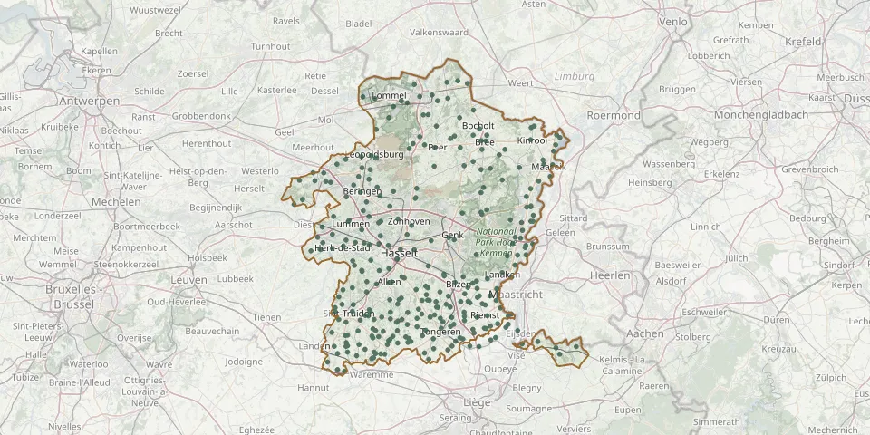 © OpenStreetMap
- Batsheers ChurchyardGPS coordinates: 50.73740° N, 5.28130° E
- Bedevaartsoord HeppeneertGPS coordinates: 51.07660° N, 5.79520° E
- Beek CemeteryGPS coordinates: 51.15498° N, 5.60311° E
- Berbroek CemeteryGPS coordinates: 50.95116° N, 5.20500° E
- Berg Cemetery (Tongeren)GPS coordinates: 50.79417° N, 5.50309° E
- Beringen-Centrum CemeteryGPS coordinates: 51.04660° N, 5.22000° E
- Beringen ( mijn )GPS coordinates: 51.07625° N, 5.21469° E
- Berkenbos CemeteryGPS coordinates: 51.04836° N, 5.32057° E
- Berlingen rondom de kerkGPS coordinates: 50.81750° N, 5.31090° E
- Beverlo Communal CemeteryGPS coordinates: 51.09308° N, 5.22458° E
- Beverst CemeteryGPS coordinates: 50.88682° N, 5.47422° E
- Beverst Old CemeteryGPS coordinates: 50.89052° N, 5.47294° E
- Bilzen Gansbeek CemeteryGPS coordinates: 50.87479° N, 5.50703° E
- Binderveld CemeteryGPS coordinates: 50.86005° N, 5.16693° E
- Bocholt CemeteryGPS coordinates: 51.16756° N, 5.58064° E
- Boekhout Centre ChurchyardGPS coordinates: 50.74639° N, 5.23364° E
- Bolderberg CemeteryGPS coordinates: 50.99104° N, 5.28201° E
- Bolderberg-Kerk CemeteryGPS coordinates: 50.98840° N, 5.27490° E
- Boorsem Cemetery, Sint-JorisstraatGPS coordinates: 50.94120° N, 5.71950° E
- Boorsem New CemeteryGPS coordinates: 50.94487° N, 5.72108° E
- Borgloon CemeteryGPS coordinates: 50.80369° N, 5.34609° E
- Borlo CemeteryGPS coordinates: 50.74125° N, 5.18119° E
- Bree Gerdingen CemeteryGPS coordinates: 51.14495° N, 5.58692° E
- Bree Witte Torenstraat CemeteryGPS coordinates: 51.14443° N, 5.60063° E
- Broekom ChurchyardGPS coordinates: 50.78217° N, 5.33222° E
- Brustem CemeteryGPS coordinates: 50.80227° N, 5.21930° E
- Buvingen CemeteryGPS coordinates: 50.75230° N, 5.17640° E
- Centrum, Helchteren CemeteryGPS coordinates: 51.05424° N, 5.39090° E
- Church of Saint StephenGPS coordinates: 50.78438° N, 5.56069° E
- Commonwealth War Graves, HasseltGPS coordinates: 50.91910° N, 5.33042° E