
Limburg
316 known cemeteries in Limburg, Belgium.
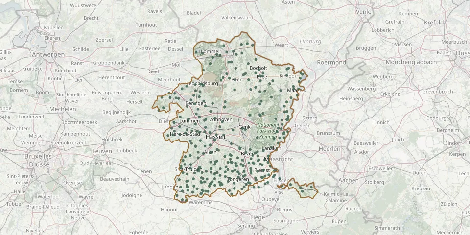 © OpenStreetMap
- Gingelom CemeteryGPS coordinates: 50.75194° N, 5.14055° E
- Glons CemeteryGPS coordinates: 50.75276° N, 5.55171° E
- Gorsem CemeteryGPS coordinates: 50.83280° N, 5.16420° E
- Gors-Opleeuw ChurchyardGPS coordinates: 50.82310° N, 5.39625° E
- Gotem CemeteryGPS coordinates: 50.80460° N, 5.31062° E
- Groot-Gelmen CemeteryGPS coordinates: 50.78543° N, 5.25780° E
- Groot-Gelmen Old ChurchyardGPS coordinates: 50.78240° N, 5.26570° E
- Grote-Brogel CemeteryGPS coordinates: 51.14918° N, 5.49341° E
- Grote-Brogel Old CemeteryGPS coordinates: 51.15327° N, 5.50534° E
- Grote-Spouwen CemeteryGPS coordinates: 50.83555° N, 5.55144° E
- Gruitrode CemeteryGPS coordinates: 51.09001° N, 5.58530° E
- Guigoven CemeteryGPS coordinates: 50.83991° N, 5.40676° E
- Gutschoven ChurchyardGPS coordinates: 50.77110° N, 5.31830° E
- Halen CemeteryGPS coordinates: 50.95031° N, 5.10580° E
- Halen Military CemeteryGPS coordinates: 50.93699° N, 5.09961° E
- Halveweg CemeteryGPS coordinates: 50.99580° N, 5.33370° E
- Hamont Old ChurchyardGPS coordinates: 51.25349° N, 5.54402° E
- Hamont Woodland CemeteryGPS coordinates: 51.25855° N, 5.51527° E
- Haren ChurchyardGPS coordinates: 50.78979° N, 5.39113° E
- Hechtel-Eksel CemeteryGPS coordinates: 51.13937° N, 5.37968° E
- Hechtel Old ChurchyardGPS coordinates: 51.12980° N, 5.36742° E
- Heers ChurchyardGPS coordinates: 50.75553° N, 5.30178° E
- Hees Cemetery, HoefwegGPS coordinates: 50.84860° N, 5.61310° E
- Heilige KruisvindingskerkGPS coordinates: 50.76820° N, 5.52150° E
- Heilig-KruiskapelGPS coordinates: 50.75930° N, 5.17720° E
- Heilig-Kruiskerk ChurchyardGPS coordinates: 50.70400° N, 5.17180° E
- Heks CemeteryGPS coordinates: 50.76988° N, 5.35765° E
- Heks CemeteryGPS coordinates: 50.76735° N, 5.36709° E
- Hendrieken Central CemeteryGPS coordinates: 50.80095° N, 5.33372° E
- Hendrieken Old CemeteryGPS coordinates: 50.79824° N, 5.32946° E