
West Flanders
503 known cemeteries in West Flanders, Belgium.
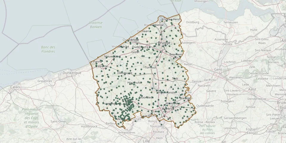 © OpenStreetMap
- BE-war Lindenhoek Chalet Military CemeteryGPS coordinates: 50.77651° N, 2.82366° E
- BE-war Oosttaverne Wood CemeteryGPS coordinates: 50.79377° N, 2.90175° E
- BE-war Railway Dugouts Burial GroundGPS coordinates: 50.83481° N, 2.90232° E
- BE-war Voormezele Enclosures No.3GPS coordinates: 50.81892° N, 2.87410° E
- BE-war Wulverghem-Lindenhoek Road Military CemeteryGPS coordinates: 50.76366° N, 2.84391° E
- Bikschote ChurchyardGPS coordinates: 50.92621° N, 2.86464° E
- Birr Cross Roads CemeteryGPS coordinates: 50.84743° N, 2.92861° E
- Bissegem Communal CemeteryGPS coordinates: 50.81907° N, 3.23097° E
- Blankenberge Communal CemeteryGPS coordinates: 51.30690° N, 3.12896° E
- Blankenberge Town Cemetery, Commonwealth PlotGPS coordinates: 51.30628° N, 3.12981° E
- Blauwepoort Farm CemeteryGPS coordinates: 50.82943° N, 2.90818° E
- Bleuet Farm CemeteryGPS coordinates: 50.88897° N, 2.83168° E
- Boezinge ChurchyardGPS coordinates: 50.89569° N, 2.85588° E
- Booitshoeke ChurchyardGPS coordinates: 51.08768° N, 2.74425° E
- Bovekerke ChurchyardGPS coordinates: 51.05429° N, 2.96339° E
- Brandhoek Military CemeteryGPS coordinates: 50.85317° N, 2.79114° E
- Brandhoek New Military CemeteryGPS coordinates: 50.85294° N, 2.78819° E
- Brandhoek New Military Cemetery No 3GPS coordinates: 50.85222° N, 2.78809° E
- Bredene ChurchyardGPS coordinates: 51.23509° N, 2.97704° E
- Bredene Priory CemeteryGPS coordinates: 51.23163° N, 2.97690° E
- Bridge House CemeteryGPS coordinates: 50.87942° N, 2.93688° E
- Brielen ChurchyardGPS coordinates: 50.86810° N, 2.84880° E
- Bruges Park CemeteryGPS coordinates: 51.25468° N, 3.19500° E
- Bruges Sint Kruis Old CemeteryGPS coordinates: 51.21417° N, 3.25059° E
- Brugge General CemeteryGPS coordinates: 51.19225° N, 3.24135° E
- Brugge Military CemeteryGPS coordinates: 51.19268° N, 3.24112° E
- Brugge-Sint-Andries New CemeteryGPS coordinates: 51.19520° N, 3.17970° E
- Brugge Sint-Michiels CemeteryGPS coordinates: 51.18758° N, 3.21539° E
- Buffs Road CemeteryGPS coordinates: 50.87659° N, 2.91646° E
- Bulskamp ChurchyardGPS coordinates: 51.04322° N, 2.65025° E