
Potosí
96 known cemeteries in Potosí, Bolivia.
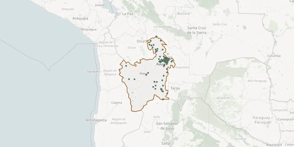 © OpenStreetMap
- Antora CemeteryGPS coordinates: 18.74209° S, 65.64179° W
- Arampampa CemeteryGPS coordinates: 17.88105° S, 66.07672° W
- Atocha General CemeteryGPS coordinates: 20.92569° S, 66.21967° W
- Atocha Old CemeteryGPS coordinates: 20.91174° S, 66.22223° W
- Betanzos CemeteryGPS coordinates: 19.53348° S, 65.30894° W
- Betanzos General CemeteryGPS coordinates: 19.56108° S, 65.45226° W
- Buey Tambo CemeteryGPS coordinates: 19.56211° S, 65.33575° W
- Cali Mali CemeteryGPS coordinates: 19.42221° S, 65.50018° W
- Campaña CemeteryGPS coordinates: 19.67120° S, 65.31337° W
- Cantumarca General CemeteryGPS coordinates: 19.58757° S, 65.78248° W
- Cassin CemeteryGPS coordinates: 19.38384° S, 65.21770° W
- Castilla Huma CemeteryGPS coordinates: 18.90139° S, 66.12663° W
- Cayara CemeteryGPS coordinates: 19.55926° S, 65.87404° W
- Chacabuco CemeteryGPS coordinates: 19.63840° S, 65.37281° W
- Charojsi CemeteryGPS coordinates: 19.61420° S, 65.41033° W
- Chayanta General CemeteryGPS coordinates: 18.45767° S, 66.43908° W
- Chullchucani CemeteryGPS coordinates: 19.46197° S, 65.63530° W
- Chuquihuta CemeteryGPS coordinates: 18.59396° S, 66.35914° W
- Chustuco CemeteryGPS coordinates: 19.51063° S, 65.33117° W
- Coipasi CemeteryGPS coordinates: 19.60815° S, 65.43396° W
- Colcha K CemeteryGPS coordinates: 20.74887° S, 67.65562° W
- Colquechaca CemeteryGPS coordinates: 18.70361° S, 66.00528° W
- Comunidad Chillco CemeteryGPS coordinates: 21.38487° S, 66.15931° W
- Cotagaita General CemeteryGPS coordinates: 20.81841° S, 65.66363° W
- El Molino CemeteryGPS coordinates: 19.51370° S, 65.81658° W
- Hualinfaya CemeteryGPS coordinates: 19.39711° S, 65.34500° W
- Huanacoma CemeteryGPS coordinates: 18.15612° S, 66.49232° W
- Huancarani CemeteryGPS coordinates: 18.73589° S, 66.14057° W
- Huanchaca CemeteryGPS coordinates: 20.31808° S, 66.68210° W
- Huari Huari CemeteryGPS coordinates: 19.44873° S, 65.59140° W