
Potosí
96 known cemeteries in Potosí, Bolivia.
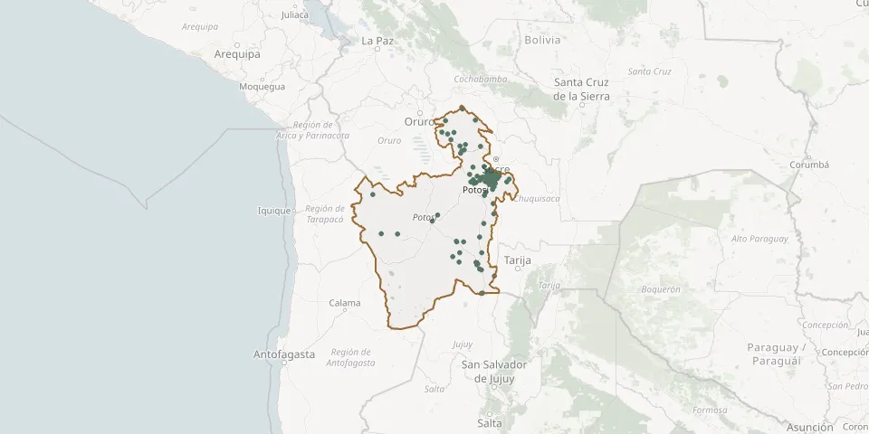 © OpenStreetMap
- Retiro CemeteryGPS coordinates: 19.59164° S, 65.28229° W
- Río Blanco CemeteryGPS coordinates: 21.17336° S, 65.60985° W
- Rodero General CemeteryGPS coordinates: 19.55625° S, 65.52447° W
- Samasa Alta CemeteryGPS coordinates: 19.50554° S, 65.63153° W
- San Antonio CemeteryGPS coordinates: 19.59388° S, 65.79941° W
- San Antonio. Colorado CemeteryGPS coordinates: 21.42616° S, 65.70877° W
- San Blas de Puita CemeteryGPS coordinates: 19.35990° S, 65.27839° W
- San Pedro de Quemes CemeteryGPS coordinates: 20.74460° S, 68.04824° W
- Santa Bárbara General CemeteryGPS coordinates: 20.92661° S, 66.04905° W
- Santa Lucía CemeteryGPS coordinates: 19.54687° S, 65.84817° W
- Santa Rosa General CemeteryGPS coordinates: 21.56452° S, 65.61786° W
- San Vicente CemeteryGPS coordinates: 21.26403° S, 66.31579° W
- Siporo CemeteryGPS coordinates: 19.36189° S, 65.46354° W
- Tacobamba CemeteryGPS coordinates: 19.20482° S, 65.55084° W
- Tambillo Alto CemeteryGPS coordinates: 21.39379° S, 65.75026° W
- Tambillo Bajo CemeteryGPS coordinates: 21.39673° S, 65.72483° W
- Tambillos Cemetery near SiporoGPS coordinates: 19.30821° S, 65.47889° W
- Tanana Alta CemeteryGPS coordinates: 19.48995° S, 65.32810° W
- Tatasi CemeteryGPS coordinates: 21.17149° S, 66.14627° W
- Tecoya Baja CemeteryGPS coordinates: 19.50758° S, 65.43434° W
- Thanta Cancha CemeteryGPS coordinates: 19.73226° S, 65.34711° W
- Tinguipaya General CemeteryGPS coordinates: 19.22285° S, 65.82327° W
- Tirispaya CemeteryGPS coordinates: 19.27423° S, 65.41600° W
- Tocla CemeteryGPS coordinates: 19.52282° S, 65.30716° W
- Torotoro CemeteryGPS coordinates: 18.13865° S, 65.76606° W
- Trapiche Bajo CemeteryGPS coordinates: 19.44816° S, 65.52602° W
- Tres Cruces General CemeteryGPS coordinates: 19.87332° S, 65.54805° W
- Tupiza General CemeteryGPS coordinates: 21.44368° S, 65.72874° W
- Tusquiña General CemeteryGPS coordinates: 20.29083° S, 65.32048° W
- Urifaya CemeteryGPS coordinates: 19.49894° S, 64.94574° W