
Espírito Santo
725 known cemeteries in Espírito Santo, Brazil.
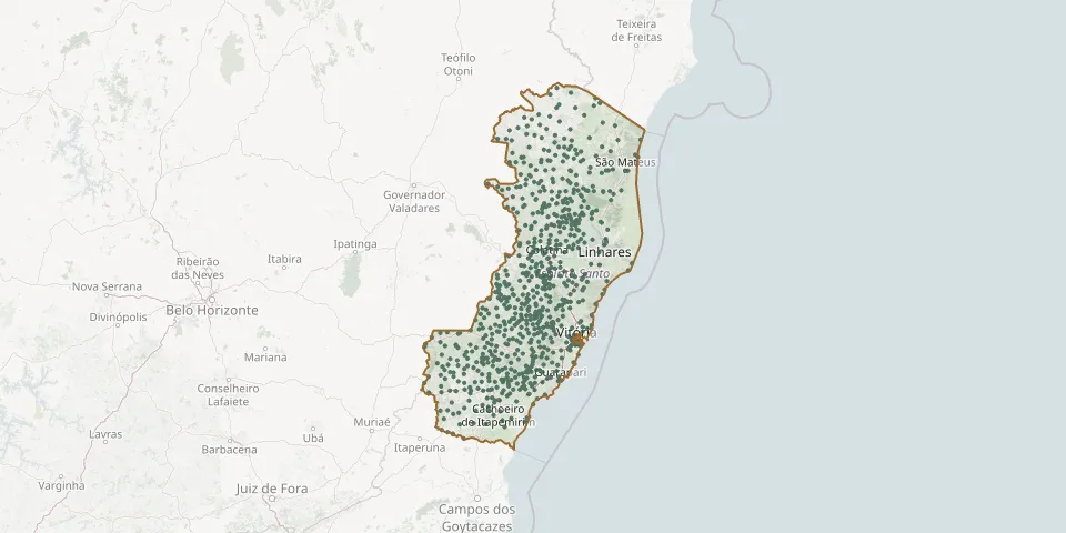 © OpenStreetMap
- São Sebastião de Barra Seca CemeteryGPS coordinates: 18.90843° S, 40.58575° W
- São Sebastião de Belém CemeteryGPS coordinates: 20.04889° S, 40.72041° W
- São Sebastião de Sobreiro CemeteryGPS coordinates: 19.74408° S, 40.90180° W
- São Sebastião do Recreio Community CemeteryGPS coordinates: 19.99295° S, 40.67337° W
- São Simão Municipal CemeteryGPS coordinates: 20.56135° S, 41.45260° W
- São Tiago CemeteryGPS coordinates: 20.72254° S, 41.68239° W
- Sao Tobias CemeteryGPS coordinates: 20.67307° S, 40.52227° W
- São Vicente CemeteryGPS coordinates: 20.66070° S, 41.08574° W
- São Vicente Community CemeteryGPS coordinates: 20.05075° S, 41.21076° W
- São Vicente de Paula Municipal CemeteryGPS coordinates: 19.53210° S, 40.62204° W
- Sapucaia CemeteryGPS coordinates: 19.36415° S, 40.60822° W
- Schwanz Community CemeteryGPS coordinates: 20.19212° S, 40.83099° W
- Segundo Território CemeteryGPS coordinates: 20.69209° S, 40.75061° W
- Serra de Cima Community CemeteryGPS coordinates: 18.78707° S, 40.47946° W
- Serra Main CemeteryGPS coordinates: 20.13010° S, 40.30838° W
- Serra Pelada CemeteryGPS coordinates: 20.00245° S, 41.02930° W
- Serra Pelada Community CemeteryGPS coordinates: 19.98528° S, 41.00516° W
- Sobreira CemeteryGPS coordinates: 20.63367° S, 41.55803° W
- Sobreiro CemeteryGPS coordinates: 19.82604° S, 41.11059° W
- Sooretama Municipal CemeteryGPS coordinates: 19.19278° S, 40.10333° W
- Suiça Lutheran Community CemeteryGPS coordinates: 20.07899° S, 40.60727° W
- Sumidouro do Pancas CemeteryGPS coordinates: 19.05120° S, 40.87090° W
- Tabocas CemeteryGPS coordinates: 19.91522° S, 40.69334° W
- Tacredo Municipal CemeteryGPS coordinates: 19.68300° S, 40.73078° W
- Tancredinho Lutheran CemeteryGPS coordinates: 19.66013° S, 40.73571° W
- Tancredinho Municipal CemeteryGPS coordinates: 19.65031° S, 40.71981° W
- Taquara CemeteryGPS coordinates: 18.03403° S, 40.15326° W
- Taquarussu CemeteryGPS coordinates: 20.56410° S, 40.98821° W
- Terra Alta Municipal CemeteryGPS coordinates: 19.44429° S, 40.38280° W
- Tijuco Preto Community CemeteryGPS coordinates: 20.23806° S, 40.90043° W