
Paraná
683 known cemeteries in Paraná, Brazil.
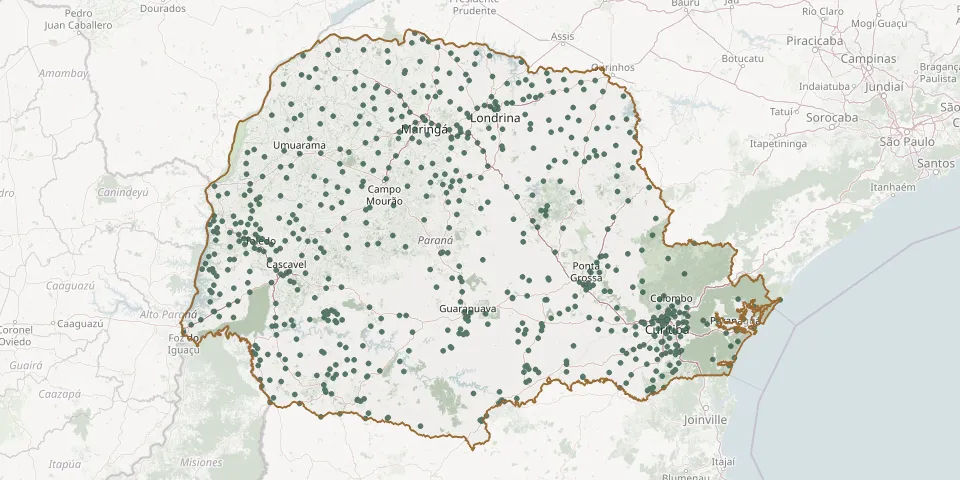 © OpenStreetMap
- Estrela CemeteryGPS coordinates: 25.34791° S, 52.93243° W
- Estr. Linha Baiana CemeteryGPS coordinates: 25.40704° S, 54.03724° W
- Farol Municipal CemeteryGPS coordinates: 24.09556° S, 52.62849° W
- Faxina CemeteryGPS coordinates: 25.77487° S, 49.18243° W
- Faxinal dos Pretos CemeteryGPS coordinates: 25.85504° S, 49.78686° W
- Fazenda Rio Grande Metropolitan Park CemeteryGPS coordinates: 25.65122° S, 49.33606° W
- Fazenda Rio Grande Municipal CemeteryGPS coordinates: 25.64600° S, 49.32005° W
- Felisberto CemeteryGPS coordinates: 24.04802° S, 50.63218° W
- Fênix Municipal CemeteryGPS coordinates: 23.90954° S, 51.97577° W
- Fernandes Pinheiro Municipal CemeteryGPS coordinates: 25.41329° S, 50.54784° W
- Figueira Municipal CemeteryGPS coordinates: 23.85129° S, 50.39481° W
- Floraí Municipal CemeteryGPS coordinates: 23.32914° S, 52.30413° W
- Flor da Serra CemeteryGPS coordinates: 25.48656° S, 53.38419° W
- Flor da Serra do Sul Municipal CemeteryGPS coordinates: 26.25640° S, 53.31128° W
- Floresta Municipal CemeteryGPS coordinates: 23.61788° S, 52.07591° W
- Florestópolis Municipal CemeteryGPS coordinates: 22.86798° S, 51.38575° W
- Floriano Cemetery, MaringáGPS coordinates: 23.52261° S, 52.04747° W
- Flórida Municipal CemeteryGPS coordinates: 23.08185° S, 51.95649° W
- Formosa do Oeste Municipal CemeteryGPS coordinates: 24.29473° S, 53.31067° W
- Foz do Jordão Municipal CemeteryGPS coordinates: 25.73662° S, 52.11329° W
- Francisco Alves Municipal CemeteryGPS coordinates: 24.07219° S, 53.85492° W
- Francisco Beltrão Municipal CemeteryGPS coordinates: 26.07188° S, 53.04689° W
- Francisco Santos Municipal CemeteryGPS coordinates: 25.77780° S, 49.33077° W
- Frei Francisco CemeteryGPS coordinates: 25.70807° S, 51.64154° W
- Frei Matias CemeteryGPS coordinates: 24.80237° S, 50.00907° W
- General Carneiro CemeteryGPS coordinates: 26.42086° S, 51.32983° W
- General Carneiro CemeteryGPS coordinates: 26.43029° S, 51.31259° W
- General Carneiro Municipal CemeteryGPS coordinates: 26.41429° S, 51.31152° W
- Godoy Moreira Municipal CemeteryGPS coordinates: 24.19637° S, 51.91948° W
- Goioerê Municipal CemeteryGPS coordinates: 24.17581° S, 53.02514° W