
Rondônia
52 known cemeteries in Rondônia, Brazil.
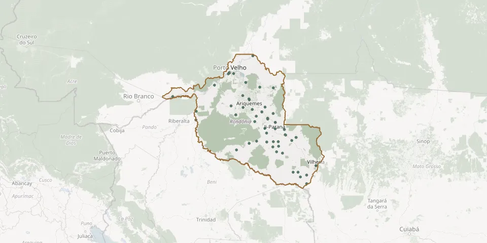 © OpenStreetMap
- Alta Floresta d'Oeste Municipal CemeteryGPS coordinates: 11.93414° S, 62.01108° W
- Alto Alegre dos Parecis Municipal CemeteryGPS coordinates: 12.14185° S, 61.85544° W
- Alto Guarajus Municipal CemeteryGPS coordinates: 13.00395° S, 61.13282° W
- Alvorada d'Oeste Municipal CemeteryGPS coordinates: 11.34065° S, 62.28830° W
- Ariquemes Municipal CemeteryGPS coordinates: 9.92701° S, 63.03346° W
- Bom Samaritano CemeteryGPS coordinates: 10.70885° S, 62.24424° W
- Buritis Municipal CemeteryGPS coordinates: 10.18498° S, 63.82297° W
- Cacoal Municipal CemeteryGPS coordinates: 11.43002° S, 61.45627° W
- Calama Municipal CemeteryGPS coordinates: 8.03396° S, 62.87731° W
- Campo Novo de Rondônia Municipal CemeteryGPS coordinates: 10.56625° S, 63.61722° W
- Campo Santo Cemetery, Ouro Preto do OesteGPS coordinates: 10.74622° S, 62.23538° W
- Campo Santo Cemetery, Pimenta BuenoGPS coordinates: 11.65679° S, 61.19424° W
- Candeias do Jamari Pioneers' CemeteryGPS coordinates: 8.79913° S, 63.71278° W
- Cidade Nova Cemetery, Nova MamoréGPS coordinates: 10.41756° S, 65.33416° W
- Colorado do Oeste CemeteryGPS coordinates: 13.12268° S, 60.55248° W
- Corumbiara Municipal CemeteryGPS coordinates: 13.00523° S, 60.92580° W
- Cristo Redentor CemeteryGPS coordinates: 13.20621° S, 60.82100° W
- Cristo Rei CemeteryGPS coordinates: 13.48664° S, 60.54972° W
- Cristo Rei CemeteryGPS coordinates: 9.18273° S, 63.18528° W
- Cujubim CemeteryGPS coordinates: 9.38512° S, 62.57688° W
- Desconhecido CemeteryGPS coordinates: 10.62273° S, 62.73037° W
- Dos Inocentes CemeteryGPS coordinates: 8.76771° S, 63.90342° W
- Extrema de Rondônia CemeteryGPS coordinates: 9.78806° S, 66.35145° W
- Jaru Municipal Cemetery No. 1GPS coordinates: 10.44018° S, 62.49049° W
- Jaru Municipal Cemetery No. 2GPS coordinates: 10.44337° S, 62.49378° W
- Machadinho d'Oeste CemeteryGPS coordinates: 9.41409° S, 61.98859° W
- Ministro Andreazza Municipal CemeteryGPS coordinates: 11.19272° S, 61.51360° W
- Monte Negro Municipal CemeteryGPS coordinates: 10.24873° S, 63.30072° W
- Nova Brasilândia d'Oeste Municipal CemeteryGPS coordinates: 11.72658° S, 62.27561° W
- Nova Mutum Paraná CemeteryGPS coordinates: 9.29481° S, 64.54041° W