
Rondônia
52 known cemeteries in Rondônia, Brazil.
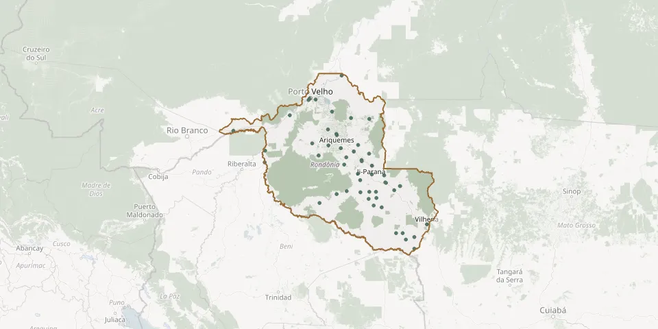 © OpenStreetMap
- Parecis Municipal CemeteryGPS coordinates: 12.19354° S, 61.59965° W
- Paz Garden CemeteryGPS coordinates: 11.53017° S, 61.00485° W
- Presidente Médici CemeteryGPS coordinates: 11.16140° S, 61.91060° W
- Recanto da Paz Cemetery, CacaulândiaGPS coordinates: 10.33996° S, 62.90632° W
- Recanto da Saudade Municipal Cemetery, Novo Horizonte do OesteGPS coordinates: 11.70628° S, 61.99139° W
- Rolim de Moura Municipal CemeteryGPS coordinates: 11.70912° S, 61.78090° W
- Rondominas CemeteryGPS coordinates: 10.50938° S, 61.99960° W
- Santa Cruz CemeteryGPS coordinates: 10.78403° S, 65.34325° W
- Santa Luzia d'Oeste Municipal CemeteryGPS coordinates: 11.90279° S, 61.76171° W
- Santo Antônio CemeteryGPS coordinates: 8.81093° S, 63.94111° W
- São Francisco de Assis CemeteryGPS coordinates: 11.52918° S, 61.00750° W
- São Francisco de Assis CemeteryGPS coordinates: 9.88718° S, 63.04467° W
- São Francisco do Guaporé Municipal CemeteryGPS coordinates: 12.06201° S, 63.58533° W
- São Miguel Arcanjo Municipal CemeteryGPS coordinates: 9.74735° S, 63.31793° W
- São Miguel do Guaporé CemeteryGPS coordinates: 11.68485° S, 62.71782° W
- Saudade Cemetery, CacoalGPS coordinates: 11.41868° S, 61.48083° W
- Saudade Municipal Cemetery, Ji-ParanáGPS coordinates: 10.88803° S, 61.90123° W
- Seringueiras Municipal CemeteryGPS coordinates: 11.78375° S, 63.03886° W
- Tarilândia CemeteryGPS coordinates: 10.85713° S, 62.79454° W
- Theobroma Municipal CemeteryGPS coordinates: 10.23789° S, 62.35103° W
- Urupá Municipal CemeteryGPS coordinates: 11.13957° S, 62.35853° W
- Vilhena Municipal CemeteryGPS coordinates: 12.72797° S, 60.14841° W