
Santa Catarina
1,559 known cemeteries in Santa Catarina, Brazil.
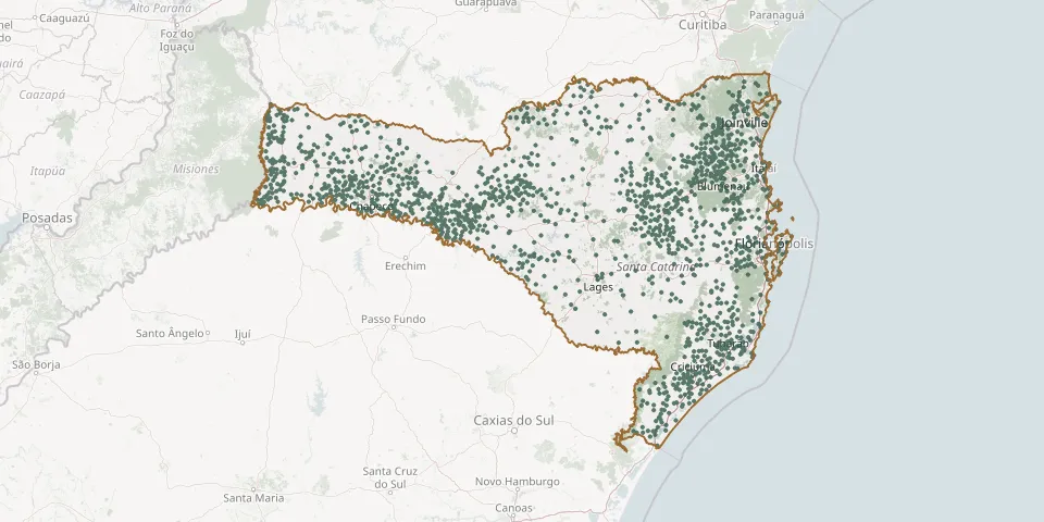 © OpenStreetMap
- Alto Lajeado Cemetery, Leoberto LealGPS coordinates: 27.56176° S, 49.27889° W
- Alto Paraguaçu CemeteryGPS coordinates: 26.38868° S, 49.91945° W
- Alto Pedrinhas CemeteryGPS coordinates: 28.47737° S, 49.12692° W
- Alto Rio Jundiá CemeteryGPS coordinates: 28.89557° S, 49.63805° W
- Alto Rio Krauel Cemetery, WitmarsumGPS coordinates: 26.97236° S, 49.93410° W
- Alto Rio Sete CemeteryGPS coordinates: 28.03743° S, 49.03212° W
- Alto São João de Benedito Novo Lutheran CemeteryGPS coordinates: 26.81293° S, 49.48121° W
- Alto Sumidor Community Cemetery, Rio do OesteGPS coordinates: 27.20670° S, 49.89337° W
- Anaburgo CemeteryGPS coordinates: 26.26418° S, 48.93266° W
- Anchieta Municipal CemeteryGPS coordinates: 26.54116° S, 53.33371° W
- Angelina Lutheran CemeteryGPS coordinates: 27.56019° S, 48.93554° W
- Angelo da Ros Municipal CemeteryGPS coordinates: 28.85075° S, 49.45179° W
- Anita Garibaldi Community CemeteryGPS coordinates: 26.89782° S, 52.60263° W
- Anita Garibaldi Municipal CemeteryGPS coordinates: 27.68101° S, 51.12643° W
- Anitápolis Central CemeteryGPS coordinates: 27.90169° S, 49.12949° W
- Anjo da Guarda Municipal Cemetery, São JoaquimGPS coordinates: 28.29162° S, 49.94356° W
- Anta Gorda CemeteryGPS coordinates: 26.09814° S, 50.50667° W
- Anta Gorda Community Cemetery, Rio do OesteGPS coordinates: 27.15187° S, 49.89248° W
- Anta Gorda Lutheran CemeteryGPS coordinates: 26.95011° S, 51.24514° W
- Apiúna Municipal CemeteryGPS coordinates: 27.03908° S, 49.38845° W
- Apóstolo André Evangelical Lutheran Church CemeteryGPS coordinates: 26.82339° S, 49.16066° W
- Apóstolo João Lutheran Cemetery, LontrasGPS coordinates: 27.17745° S, 49.54981° W
- Apóstolo João Lutheran Church CemeteryGPS coordinates: 26.73865° S, 49.17793° W
- Arabutã CemeteryGPS coordinates: 27.15104° S, 52.13850° W
- Araçá CemeteryGPS coordinates: 26.64706° S, 52.26137° W
- Araçá Community CemeteryGPS coordinates: 27.62240° S, 50.97619° W
- Araçatuba Municipal CemeteryGPS coordinates: 28.12240° S, 48.69010° W
- Arapongas Lutheran Cemetery, IndaialGPS coordinates: 26.89028° S, 49.27967° W
- Araponguinhas Lutheran Cemetery, TimbóGPS coordinates: 26.85551° S, 49.28619° W
- Araquari German CemeteryGPS coordinates: 26.43743° S, 48.80886° W