
Prince Edward Island
235 known cemeteries in Prince Edward Island, Canada.
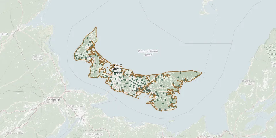 © OpenStreetMap
- The Peoples Cemetery Mount StewartGPS coordinates: 46.36393° N, 62.85040° W
- Saint John's Presbyterian/Belfast Memorial CemeteryGPS coordinates: 46.07759° N, 62.87634° W
- Alberton CemeteryGPS coordinates: 46.80568° N, 64.06509° W
- Alexandra Baptist CemeteryGPS coordinates: 46.19680° N, 63.02308° W
- All Saints Parish CemeteryGPS coordinates: 46.24236° N, 62.62283° W
- Alma United Baptist CemeteryGPS coordinates: 46.85619° N, 64.11461° W
- Annandale United / Presbyterian Cemetery (old)GPS coordinates: 46.27130° N, 62.42724° W
- Argyle Shore CemeteryGPS coordinates: 46.17318° N, 63.37085° W
- Baptist Cemetery UnionGPS coordinates: 46.79463° N, 64.09434° W
- Bay Fortune United CemeteryGPS coordinates: 46.32478° N, 62.36264° W
- Beach Point Community CemeteryGPS coordinates: 46.01567° N, 62.48144° W
- Beaton Pioneer CemeteryGPS coordinates: 46.00859° N, 62.88174° W
- Belmont Baptist CemeteryGPS coordinates: 46.48579° N, 63.81604° W
- Bethel United Church CemeteryGPS coordinates: 46.67846° N, 64.38094° W
- Bideford United CemeteryGPS coordinates: 46.60511° N, 63.91485° W
- Birch Hill Free Church of Scotland CemeteryGPS coordinates: 46.21607° N, 62.96217° W
- Bloomfield United CemeteryGPS coordinates: 46.73690° N, 64.16627° W
- Brackley Beach CemeteryGPS coordinates: 46.40570° N, 63.19467° W
- Brae United CemeteryGPS coordinates: 46.66045° N, 64.19232° W
- Breadalbane People's CemeteryGPS coordinates: 46.35271° N, 63.50360° W
- Brookfield Presbyterian CemeteryGPS coordinates: 46.32579° N, 63.28219° W
- Brooklyn Church of Scotland CemeteryGPS coordinates: 46.09459° N, 62.66807° W
- Brudenell Island Pioneer CemeteryGPS coordinates: 46.19656° N, 62.57931° W
- Brudenell Point CemeteryGPS coordinates: 46.18752° N, 62.59339° W
- Burnside Presbyterian CemeteryGPS coordinates: 46.22403° N, 63.25618° W
- Caledonia Presbyterian Church CemeteryGPS coordinates: 46.04998° N, 62.71783° W
- Campbellton United Presbyterian CemeteryGPS coordinates: 46.79212° N, 64.30309° W
- Canoe Cove Presbyterian CemeteryGPS coordinates: 46.15094° N, 63.30166° W
- Cape Traverse Free Church CemeteryGPS coordinates: 46.23870° N, 63.63160° W
- Cape Traverse United Church CemeteryGPS coordinates: 46.24241° N, 63.65632° W