
Prince Edward Island
235 known cemeteries in Prince Edward Island, Canada.
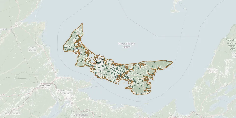 © OpenStreetMap
- Geddie Memorial CemeteryGPS coordinates: 46.49433° N, 63.50766° W
- Georgetown Baptist CemeteryGPS coordinates: 46.19101° N, 62.53479° W
- Glasgow Road CemeteryGPS coordinates: 46.35471° N, 63.26451° W
- Glenwood United CemeteryGPS coordinates: 46.64545° N, 64.31184° W
- Greenvale United Church CemeteryGPS coordinates: 46.34384° N, 63.32109° W
- Hampshire United Methodist CemeteryGPS coordinates: 46.28631° N, 63.27459° W
- Hartsville CemeteryGPS coordinates: 46.31950° N, 63.39241° W
- Hazelbrook Baptist CemeteryGPS coordinates: 46.21853° N, 62.99149° W
- Highfield Cemetery aka Saint Anthony Presbyterian ChurchGPS coordinates: 46.28603° N, 63.17450° W
- Hillcrest CemeteryGPS coordinates: 46.80991° N, 64.07755° W
- Historic Roman Catholic Cemetery, CharlottetownGPS coordinates: 46.24415° N, 63.12466° W
- Holy Trinity CemeteryGPS coordinates: 46.86404° N, 64.10678° W
- Hunter River Presbyterian CemeteryGPS coordinates: 46.35679° N, 63.35033° W
- Hyde and Crosby Pioneer CemeteryGPS coordinates: 46.20698° N, 63.21414° W
- Immaculate Conception CemeteryGPS coordinates: 46.91341° N, 64.15580° W
- Immaculate Conception CemeteryGPS coordinates: 46.48882° N, 63.98896° W
- Immaculate Conception ChurchGPS coordinates: 46.63922° N, 64.18980° W
- Kensington People's CemeteryGPS coordinates: 46.44783° N, 63.62920° W
- Kingsboro CemeteryGPS coordinates: 46.40474° N, 62.08581° W
- Kingston United Church Cemetery 1863GPS coordinates: 46.26275° N, 63.27856° W
- Knutsford United Church CemeteryGPS coordinates: 46.69811° N, 64.27511° W
- Launching Catholic Pioneer CemeteryGPS coordinates: 46.22054° N, 62.43132° W
- Linkletter CemeteryGPS coordinates: 46.40159° N, 63.85632° W
- Little Sands CemeteryGPS coordinates: 45.96912° N, 62.67102° W
- Long Creek United Baptist CemeteryGPS coordinates: 46.17198° N, 63.27055° W
- Lorne Valley / Saint Andrew CemeteryGPS coordinates: 46.27157° N, 62.69888° W
- Lot 14 / Birch Hill Presbyterian CemeteryGPS coordinates: 46.55192° N, 63.87292° W
- Lot 14 / Birch Hill United Church CemeteryGPS coordinates: 46.55193° N, 63.87357° W
- Lot 16 United Church CemeteryGPS coordinates: 46.46683° N, 63.85777° W
- Lower Bedeque CemeteryGPS coordinates: 46.34701° N, 63.73359° W