
Región de los Lagos
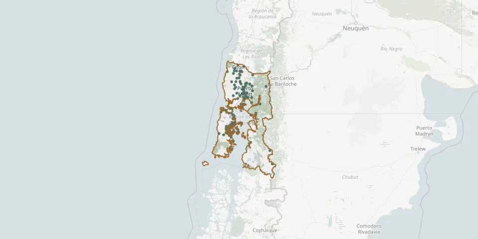
142 known cemeteries in Región de los Lagos, Chile.
 © OpenStreetMap
- Rahue Alto Municipal CemeteryGPS coordinates: 40.58315° S, 73.17368° W
- Recuerdo Park Municipal Cemetery, LlanquihueGPS coordinates: 41.27592° S, 72.98935° W
- Rilán CemeteryGPS coordinates: 42.52100° S, 73.63140° W
- Río Chico CemeteryGPS coordinates: 41.44677° S, 72.82026° W
- Río Negro Catholic CemeteryGPS coordinates: 40.80298° S, 73.21938° W
- Rio Negro Municipal CemeteryGPS coordinates: 40.80389° S, 73.21811° W
- Salto Chico CemeteryGPS coordinates: 41.48547° S, 73.27514° W
- San Agustín CemeteryGPS coordinates: 41.72085° S, 73.06105° W
- San Juan CemeteryGPS coordinates: 42.33318° S, 73.50177° W
- San Miguel CemeteryGPS coordinates: 42.62397° S, 73.50265° W
- San Pablo Municipal CemeteryGPS coordinates: 40.41117° S, 73.00293° W
- Santa Bárbara Church and CemeteryGPS coordinates: 41.31269° S, 73.31369° W
- Tegualda CemeteryGPS coordinates: 41.03376° S, 73.42073° W
- Tenaún CemeteryGPS coordinates: 42.33244° S, 73.37193° W
- Tenglo Island CemeteryGPS coordinates: 41.50598° S, 72.97302° W
- Terao CemeteryGPS coordinates: 42.70117° S, 73.64714° W
- Tey CemeteryGPS coordinates: 42.42811° S, 73.71708° W
- Totoral Lutheran CemeteryGPS coordinates: 41.22853° S, 73.01160° W
- Valle del Cedrón Park CemeteryGPS coordinates: 40.56782° S, 73.17442° W
- Vilupulli CemeteryGPS coordinates: 42.60441° S, 73.78955° W
- Voigue CemeteryGPS coordinates: 42.30172° S, 73.21725° W
- Yutuy CemeteryGPS coordinates: 42.51764° S, 73.75224° W