
Antioquia
117 known cemeteries in Antioquia, Colombia.
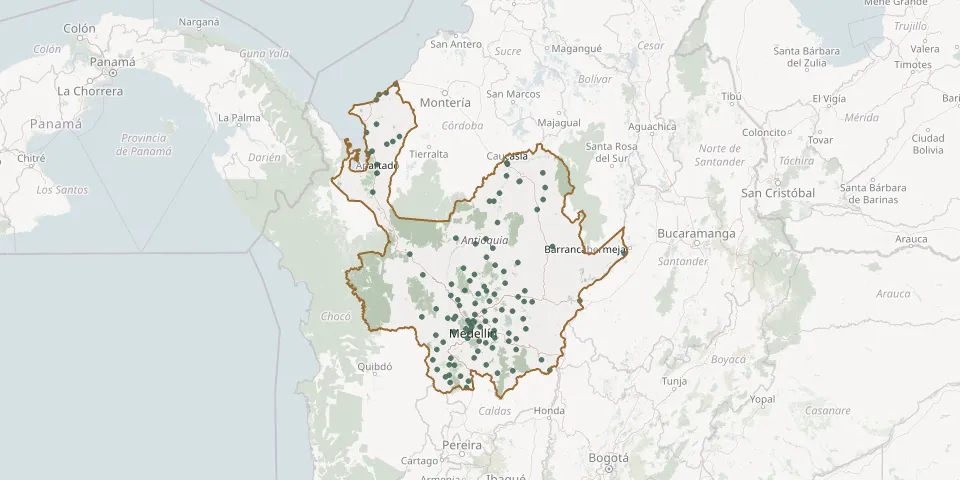 © OpenStreetMap
- Cristo Rey CemeteryGPS coordinates: 6.97120° N, 75.42778° W
- Currulao CemeteryGPS coordinates: 7.97865° N, 76.63264° W
- Cuturú CemeteryGPS coordinates: 7.72871° N, 74.78494° W
- Damaquiel Jardín del Edén CemeteryGPS coordinates: 8.73908° N, 76.60829° W
- De La America CemeteryGPS coordinates: 6.25391° N, 75.61538° W
- De San Javier CemeteryGPS coordinates: 6.25376° N, 75.61515° W
- Dios Padre CemeteryGPS coordinates: 7.88756° N, 74.81065° W
- Donmatías CemeteryGPS coordinates: 6.48865° N, 75.39603° W
- Ebéjico Municipal CemeteryGPS coordinates: 6.32409° N, 75.76796° W
- El Bagre Municipal CemeteryGPS coordinates: 7.59780° N, 74.80574° W
- El Carmen de Viboral CemeteryGPS coordinates: 6.09076° N, 75.33717° W
- El Dos CemeteryGPS coordinates: 8.12318° N, 76.68374° W
- El Pando CemeteryGPS coordinates: 7.79869° N, 75.06249° W
- El Pando CemeteryGPS coordinates: 7.79476° N, 75.06842° W
- El Porvenir CemeteryGPS coordinates: 7.16988° N, 75.43622° W
- El Retiro CemeteryGPS coordinates: 6.05409° N, 75.50800° W
- El Rosal CemeteryGPS coordinates: 5.79458° N, 75.83838° W
- El Totumo CemeteryGPS coordinates: 8.32899° N, 76.74527° W
- Entrerríos CemeteryGPS coordinates: 6.56878° N, 75.51973° W
- Frontino CemeteryGPS coordinates: 6.77880° N, 76.12950° W
- Girardota Municipal CemeteryGPS coordinates: 6.37932° N, 75.44957° W
- Gómez Plata Municipal CemeteryGPS coordinates: 6.68660° N, 75.22250° W
- Granada CemeteryGPS coordinates: 6.14185° N, 75.18270° W
- Guadalupe CemeteryGPS coordinates: 6.81329° N, 75.23916° W
- Guarne CemeteryGPS coordinates: 6.27329° N, 75.44082° W
- Guarumo CemeteryGPS coordinates: 7.85630° N, 75.20808° W
- Hoyorrico CemeteryGPS coordinates: 6.60176° N, 75.42755° W
- Itagui CemeteryGPS coordinates: 6.16941° N, 75.61507° W
- Jardín Cemetery (Heritage Town)GPS coordinates: 5.60037° N, 75.82817° W
- Jardín de la Esperanza Cemetery, BelmiraGPS coordinates: 6.60788° N, 75.66632° W