
Olomouc Region
413 known cemeteries in Olomouc Region, Czechia.
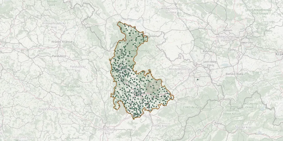 © OpenStreetMap
- Opatovice CemeteryGPS coordinates: 49.50084° N, 17.73345° E
- Oplocany CemeteryGPS coordinates: 49.41070° N, 17.26958° E
- Osek nad Bečvou CemeteryGPS coordinates: 49.51111° N, 17.52628° E
- Osek nad Bečvou CemeteryGPS coordinates: 49.51590° N, 17.52589° E
- Oskava Cemetery, MostkovGPS coordinates: 49.89130° N, 17.13125° E
- Oskava Cemetery, Václavov near OskavaGPS coordinates: 49.90544° N, 17.11000° E
- Ostružná CemeteryGPS coordinates: 50.18457° N, 17.05217° E
- Palonín CemeteryGPS coordinates: 49.73158° N, 16.95361° E
- Paršovice CemeteryGPS coordinates: 49.49817° N, 17.70995° E
- Partutovice CemeteryGPS coordinates: 49.63420° N, 17.70962° E
- Paseka CemeteryGPS coordinates: 49.79554° N, 17.22914° E
- Pavlov CemeteryGPS coordinates: 49.74431° N, 16.88642° E
- Pavlovice u Přerova CemeteryGPS coordinates: 49.47059° N, 17.55147° E
- Písařov CemeteryGPS coordinates: 50.00681° N, 16.79936° E
- Písečná Cemetery near JeseníkGPS coordinates: 50.27283° N, 17.25431° E
- Plumlov Holy Trinity ChurchyardGPS coordinates: 49.46868° N, 17.01732° E
- Pňovice CemeteryGPS coordinates: 49.72742° N, 17.16741° E
- Pobučí CemeteryGPS coordinates: 49.84472° N, 16.85483° E
- Podlesí CemeteryGPS coordinates: 50.07353° N, 16.85897° E
- Podolí CemeteryGPS coordinates: 49.44469° N, 17.52189° E
- Postřelmov CemeteryGPS coordinates: 49.90597° N, 16.91017° E
- Postřelmůvek CemeteryGPS coordinates: 49.91975° N, 16.87992° E
- Potůčník CemeteryGPS coordinates: 50.06469° N, 16.97553° E
- Přerov New Jewish CemeteryGPS coordinates: 49.44457° N, 17.45966° E
- Prosenice CemeteryGPS coordinates: 49.49256° N, 17.48115° E
- Prostějov Municipal and Jewish CemeteryGPS coordinates: 49.45615° N, 17.11417° E
- Rájec CemeteryGPS coordinates: 49.85142° N, 16.87667° E
- Rohle CemeteryGPS coordinates: 49.86178° N, 17.01628° E
- Rohle CemeteryGPS coordinates: 49.85508° N, 16.99547° E
- Rovensko CemeteryGPS coordinates: 49.90575° N, 16.88325° E