
Olomouc Region
413 known cemeteries in Olomouc Region, Czechia.
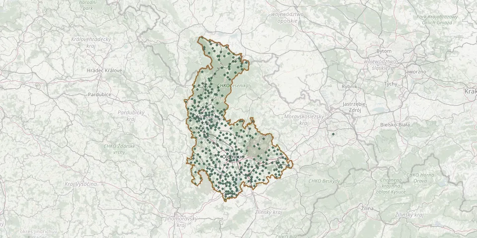 © OpenStreetMap
- Velké Kunětice CemeteryGPS coordinates: 50.32547° N, 17.26086° E
- Velký Újezd CemeteryGPS coordinates: 49.57520° N, 17.48707° E
- Vernířovice CemeteryGPS coordinates: 50.03067° N, 17.13294° E
- Veselíčko CemeteryGPS coordinates: 49.52751° N, 17.51258° E
- Vilémov CemeteryGPS coordinates: 49.63789° N, 16.99419° E
- Vlčice Cemetery near JavorníkGPS coordinates: 50.34653° N, 17.04631° E
- Vojnovice Former Church with CemeteryGPS coordinates: 49.72234° N, 17.59052° E
- Vojtíškov CemeteryGPS coordinates: 50.10322° N, 16.87572° E
- Vysoké Žibřidovice CemeteryGPS coordinates: 50.11761° N, 16.91669° E
- Zábřeh CemeteryGPS coordinates: 49.86961° N, 16.82614° E
- Zábřeh CemeteryGPS coordinates: 49.86375° N, 16.89889° E
- Zábřeh na Moravě CemeteryGPS coordinates: 49.87950° N, 16.85900° E
- Zábřeh-Skalička CemeteryGPS coordinates: 49.86586° N, 16.87243° E
- Zálesí CemeteryGPS coordinates: 50.35923° N, 16.93390° E
- Žárová CemeteryGPS coordinates: 50.04899° N, 16.98695° E
- Zborov CemeteryGPS coordinates: 49.94558° N, 16.82812° E
- Želechovice Cemetery near UničovGPS coordinates: 49.75109° N, 17.14684° E
- Želeč na Hané CemeteryGPS coordinates: 49.34578° N, 17.10552° E
- Žerotín CemeteryGPS coordinates: 49.72840° N, 17.18800° E
- Zlaté Hory Cemetery, RejvízGPS coordinates: 50.23088° N, 17.30846° E
- Zlaté Hory Jewish CemeteryGPS coordinates: 50.26504° N, 17.40024° E
- Zlaté Hory Russian Woodland CemeteryGPS coordinates: 50.19317° N, 17.28024° E
- Zvole CemeteryGPS coordinates: 49.83720° N, 16.91367° E