
Berlin
208 known cemeteries in Berlin, Germany.
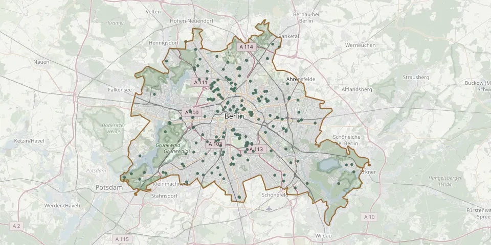 © OpenStreetMap
- Berlin Turkish CemeteryGPS coordinates: 52.48165° N, 13.40943° E
- Berlin War Graves CemeteryGPS coordinates: 52.52517° N, 13.35083° E
- Bethlehem or Bohemian Congregation Cemetery, KreuzbergGPS coordinates: 52.49565° N, 13.39187° E
- Biesdorf CemeteryGPS coordinates: 52.50950° N, 13.56701° E
- Bohnsdorf CemeteryGPS coordinates: 52.39986° N, 13.55873° E
- Britz Cemetery IGPS coordinates: 52.46000° N, 13.44608° E
- Britz Cemetery IIGPS coordinates: 52.44567° N, 13.43127° E
- Buch Castle ChurchyardGPS coordinates: 52.63531° N, 13.49818° E
- Buchholz Municipal CemeteryGPS coordinates: 52.60929° N, 13.42690° E
- Cathedral Cemetery II, WeddingGPS coordinates: 52.55807° N, 13.33990° E
- Cemetery of the March Fallen, BerlinGPS coordinates: 52.52430° N, 13.43620° E
- Domgemeinde ChurchyardGPS coordinates: 52.56008° N, 13.34387° E
- Dorotheenstadt Cemetery III, ReinickendorfGPS coordinates: 52.56287° N, 13.33225° E
- Dorotheenstädtisch-Friedrichswerderscher CemeteryGPS coordinates: 52.52807° N, 13.38381° E
- Emmaus Churchyard, BerlinGPS coordinates: 52.46286° N, 13.42984° E
- Falkenberg Village ChurchyardGPS coordinates: 52.57054° N, 13.53777° E
- Fliesstal Cemetery, TegelGPS coordinates: 52.59675° N, 13.28803° E
- Friedrichshain Evangelical CemeteriesGPS coordinates: 52.52121° N, 13.44258° E
- Frohnau CemeteryGPS coordinates: 52.63953° N, 13.26483° E
- Gerichtstrasse Urn Cemetery, WeddingGPS coordinates: 52.54618° N, 13.36403° E
- Gethsemane Cemetery, NordendGPS coordinates: 52.59587° N, 13.41005° E
- Große Hamburger Straße Jewish Cemetery, BerlinGPS coordinates: 52.52427° N, 13.39973° E
- Hallesches Tor CemeteriesGPS coordinates: 52.49517° N, 13.39244° E
- Heerstrasse Jewish CemeteryGPS coordinates: 52.50510° N, 13.22196° E
- Heiligensee Village ChurchyardGPS coordinates: 52.60770° N, 13.21270° E
- Heinersdorf CemeteryGPS coordinates: 52.57468° N, 13.43833° E
- Heinersdorf kirche bei MünchebergGPS coordinates: 52.45700° N, 14.21630° E
- Hermsdorf Cemetery IGPS coordinates: 52.61080° N, 13.30313° E
- Hermsdorf Cemetery IIGPS coordinates: 52.62680° N, 13.29105° E
- Holy Cross Churchyard, MariendorfGPS coordinates: 52.44931° N, 13.39060° E