
Berlin
208 known cemeteries in Berlin, Germany.
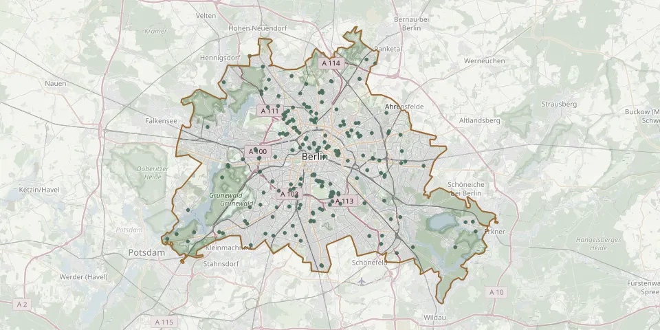 © OpenStreetMap
- Marzahn Former Village CemeteryGPS coordinates: 52.54373° N, 13.56568° E
- Marzahn Park CemeteryGPS coordinates: 52.54788° N, 13.54314° E
- Moabit Officials' Cemetery of the Former Cellular PrisonGPS coordinates: 52.52821° N, 13.36538° E
- Müggelheim Woodland CemeteryGPS coordinates: 52.40703° N, 13.67539° E
- Nazareth Churchyard II, ReinickendorfGPS coordinates: 52.56622° N, 13.33544° E
- Nordend Bereich Frieden-Himmelfahrt CemeteryGPS coordinates: 52.59511° N, 13.40413° E
- Nordend Bereich Gethsemane CemeteryGPS coordinates: 52.59461° N, 13.41005° E
- Nordend Bereich Zion CemeteryGPS coordinates: 52.59735° N, 13.40865° E
- Oberschöneweide Woodland CemeteryGPS coordinates: 52.46380° N, 13.53350° E
- Pankow Cemetery IGPS coordinates: 52.56978° N, 13.39800° E
- Pankow II CemeteryGPS coordinates: 52.56349° N, 13.39741° E
- Pankow III CemeteryGPS coordinates: 52.57190° N, 13.38750° E
- Pankow IV CemeteryGPS coordinates: 52.58355° N, 13.40896° E
- Pankow IX CemeteryGPS coordinates: 52.60860° N, 13.42865° E
- Pankow VII CemeteryGPS coordinates: 52.59413° N, 13.36581° E
- Pappellallee CemeteryGPS coordinates: 52.54306° N, 13.41556° E
- Pfaueninsel Cemetery at NikolskoeGPS coordinates: 52.42321° N, 13.11860° E
- Plötzensee Cemetery, BerlinGPS coordinates: 52.54562° N, 13.33120° E
- Priesterweg CemeteryGPS coordinates: 52.46925° N, 13.35817° E
- Rahnsdorf CemeteryGPS coordinates: 52.43748° N, 13.69597° E
- Rahnsdorf-Wilhelmshagen CemeteryGPS coordinates: 52.43825° N, 13.71042° E
- Reinickendorf War CemeteryGPS coordinates: 52.57697° N, 13.35120° E
- Resurrection Cemetery, BerlinGPS coordinates: 52.54939° N, 13.46804° E
- Rosenthal Evangelical Parish CemeteryGPS coordinates: 52.60565° N, 13.37763° E
- Russisch-Orthodoxer CemeteryGPS coordinates: 52.57766° N, 13.30072° E
- Schöneberg Cemetery IGPS coordinates: 52.47667° N, 13.34586° E
- Schöneberg II CemeteryGPS coordinates: 52.45882° N, 13.36642° E
- Schönholzer Heide Soviet War MemorialGPS coordinates: 52.58112° N, 13.37330° E
- Schönholz Heide War CemeteryGPS coordinates: 52.57715° N, 13.38354° E
- Seestrasse Urn Cemetery, WeddingGPS coordinates: 52.55280° N, 13.35513° E