
Brandenburg
2,113 known cemeteries in Brandenburg, Germany.
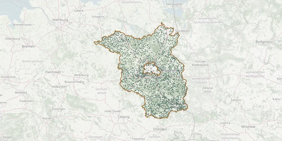 © OpenStreetMap
- Ehemals Zellinger Loose CemeteryGPS coordinates: 52.73839° N, 14.34513° E
- Eiche CemeteryGPS coordinates: 52.40600° N, 12.99090° E
- Eiche CemeteryGPS coordinates: 52.56300° N, 13.58990° E
- Eichenfelde CemeteryGPS coordinates: 53.21118° N, 12.46762° E
- Eichenhain Woodland CemeteryGPS coordinates: 52.76963° N, 14.02177° E
- Eichholz CemeteryGPS coordinates: 51.60742° N, 13.64924° E
- Eichhorst CemeteryGPS coordinates: 52.89188° N, 13.63797° E
- Eichow CemeteryGPS coordinates: 51.75999° N, 14.13084° E
- Eichwalde CemeteryGPS coordinates: 52.36541° N, 13.61766° E
- Eichwerder CemeteryGPS coordinates: 52.72012° N, 14.19556° E
- Eisdorf CemeteryGPS coordinates: 51.84137° N, 13.92516° E
- Eisenhüttenstadt Island CemeteryGPS coordinates: 52.12880° N, 14.65509° E
- Eldenburg CemeteryGPS coordinates: 53.11546° N, 11.43975° E
- Elisabethhöhe CemeteryGPS coordinates: 52.33940° N, 12.87871° E
- Elisenau CemeteryGPS coordinates: 52.64058° N, 13.61277° E
- Ellershagen CemeteryGPS coordinates: 53.21382° N, 12.29148° E
- Elstal CemeteryGPS coordinates: 52.54575° N, 12.99188° E
- Elsterwerda Soviet Cemetery of HonourGPS coordinates: 51.46821° N, 13.53467° E
- Emstal CemeteryGPS coordinates: 52.30073° N, 12.77152° E
- ErbbegräbnisGPS coordinates: 51.74121° N, 14.36363° E
- ErbbegräbnisGPS coordinates: 51.69768° N, 13.62960° E
- Erbbegräbnisstätte der Familie von RochowGPS coordinates: 52.33416° N, 12.54028° E
- Erbbegräbnis zu LynarGPS coordinates: 51.86160° N, 13.95442° E
- Erdbegräbnis am SternGPS coordinates: 52.10849° N, 12.44674° E
- Erlengrund - Wólšyna CemeteryGPS coordinates: 51.81566° N, 14.34366° E
- Eulo CemeteryGPS coordinates: 51.75350° N, 14.61810° E
- Evangelical Church Cemetery, SiethenGPS coordinates: 52.28400° N, 13.20986° E
- Fahrland CemeteryGPS coordinates: 52.47184° N, 13.00720° E
- Falkenberg CemeteryGPS coordinates: 51.85019° N, 13.56614° E
- Falkenberg CemeteryGPS coordinates: 51.58795° N, 13.22613° E