
Brandenburg
2,113 known cemeteries in Brandenburg, Germany.
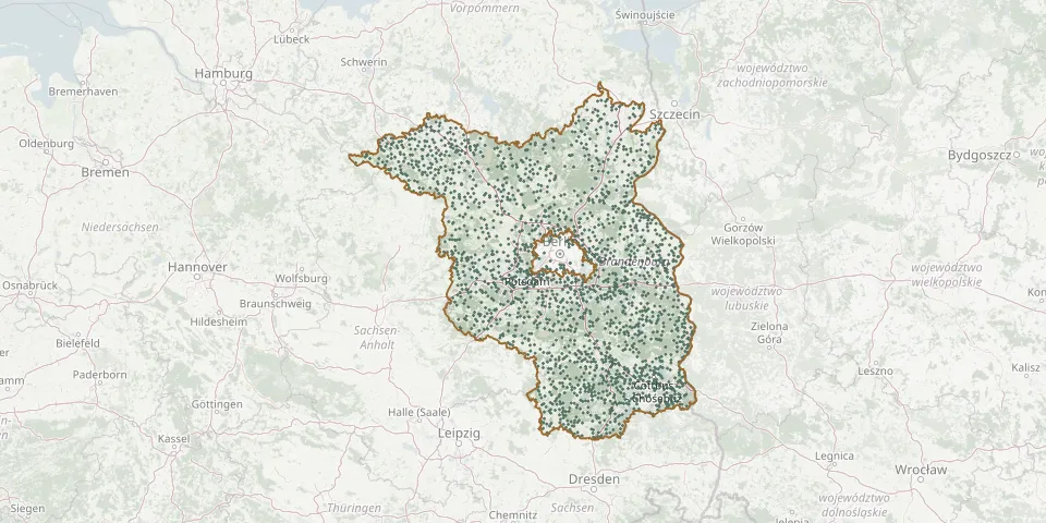 © OpenStreetMap
- Güldendorf CemeteryGPS coordinates: 52.31573° N, 14.53970° E
- Gülitz CemeteryGPS coordinates: 53.19955° N, 11.97083° E
- Gulow CemeteryGPS coordinates: 53.15470° N, 11.88195° E
- Gumtow CemeteryGPS coordinates: 52.98043° N, 12.25837° E
- Günthersdorf CemeteryGPS coordinates: 52.09248° N, 14.31030° E
- Gusow CemeteryGPS coordinates: 52.57005° N, 14.35913° E
- Güstebieser Loose CemeteryGPS coordinates: 52.75319° N, 14.29467° E
- Güstow CemeteryGPS coordinates: 53.32454° N, 13.77996° E
- Guteborn CemeteryGPS coordinates: 51.42463° N, 13.92717° E
- Gutengermendorf CemeteryGPS coordinates: 52.93987° N, 13.17378° E
- Gutenpaaren Village CemeteryGPS coordinates: 52.47856° N, 12.76581° E
- Güterfelde CemeteryGPS coordinates: 52.35888° N, 13.19453° E
- Güterfelde Mill CemeteryGPS coordinates: 52.36625° N, 13.20314° E
- Güterfelde Russian Military CemeteryGPS coordinates: 52.37874° N, 13.16752° E
- Güterfelde Village ChurchyardGPS coordinates: 52.36633° N, 13.19530° E
- Haage CemeteryGPS coordinates: 52.67581° N, 12.59816° E
- Haasower Ausbau CemeteryGPS coordinates: 51.74683° N, 14.42248° E
- Hagelberg CemeteryGPS coordinates: 52.13776° N, 12.51845° E
- Haidemühl CemeteryGPS coordinates: 51.60876° N, 14.40973° E
- Hakenberg CemeteryGPS coordinates: 52.77671° N, 12.83072° E
- Halbe Forest CemeteryGPS coordinates: 52.10295° N, 13.69409° E
- Halenbeck CemeteryGPS coordinates: 53.24466° N, 12.31576° E
- Hammer CemeteryGPS coordinates: 52.88122° N, 13.43804° E
- Hänchen CemeteryGPS coordinates: 51.72389° N, 14.27484° E
- Hangelsberg Cemetery at the StationGPS coordinates: 52.39846° N, 13.92184° E
- Hangelsberg Woodland CemeteryGPS coordinates: 52.38865° N, 13.95107° E
- Hardenbeck Cemetery (Boitzenburger Land)GPS coordinates: 53.25939° N, 13.54363° E
- Harnekop CemeteryGPS coordinates: 52.68312° N, 14.00676° E
- Harnischdorf CemeteryGPS coordinates: 51.68504° N, 14.33942° E
- Hartmannsdorf CemeteryGPS coordinates: 51.96563° N, 13.89052° E