
Brandenburg
2,113 known cemeteries in Brandenburg, Germany.
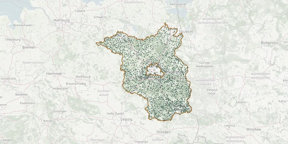 © OpenStreetMap
- Niemegk CemeteryGPS coordinates: 52.07193° N, 12.69688° E
- Niendorf CemeteryGPS coordinates: 51.86205° N, 13.38207° E
- Niewisch CemeteryGPS coordinates: 52.07653° N, 14.22938° E
- Niewitz CemeteryGPS coordinates: 51.93459° N, 13.78234° E
- Nitzahn CemeteryGPS coordinates: 52.46645° N, 12.35313° E
- Nonnendorf CemeteryGPS coordinates: 51.90386° N, 13.26261° E
- Noppern Community Commune Calauer Vorstadt Cemetery, LuckauGPS coordinates: 51.85317° N, 13.72416° E
- Noßdorf CemeteryGPS coordinates: 51.72282° N, 14.61012° E
- Oberjünne CemeteryGPS coordinates: 52.27959° N, 12.63982° E
- Obersdorf CemeteryGPS coordinates: 52.53943° N, 14.17320° E
- Ober Teschnitz Woodland CemeteryGPS coordinates: 51.57622° N, 14.36098° E
- Oderberg Mountain CemeteryGPS coordinates: 52.86645° N, 14.03652° E
- Oderin CemeteryGPS coordinates: 52.07220° N, 13.72201° E
- Oegeln CemeteryGPS coordinates: 52.17856° N, 14.28040° E
- Oelsen CemeteryGPS coordinates: 52.13526° N, 14.38150° E
- Ogrosen CemeteryGPS coordinates: 51.71550° N, 14.04098° E
- Opfer 2. WeltkriegGPS coordinates: 52.46092° N, 13.49075° E
- Oppelhain CemeteryGPS coordinates: 51.55639° N, 13.59338° E
- Ortrand CemeteryGPS coordinates: 51.37387° N, 13.75706° E
- Ortwig CemeteryGPS coordinates: 52.70350° N, 14.36004° E
- Oschätzchen Cemetery and ChurchGPS coordinates: 51.46980° N, 13.38894° E
- Ossendorf CemeteryGPS coordinates: 52.06070° N, 14.57584° E
- Ottendorf - Otašojce CemeteryGPS coordinates: 51.85888° N, 14.40055° E
- Ottendorf - Otašojce CemeteryGPS coordinates: 51.85444° N, 14.42197° E
- Our Lady Cemetery, JüterbogGPS coordinates: 51.99074° N, 13.07253° E
- Paaren im Glien CemeteryGPS coordinates: 52.65473° N, 12.98075° E
- Pabstthum CemeteryGPS coordinates: 52.85000° N, 12.93372° E
- Pankow VIII CemeteryGPS coordinates: 52.61740° N, 13.37972° E
- Pankow X Blankenburg State CemeteryGPS coordinates: 52.59495° N, 13.46031° E
- Pankow XI CemeteryGPS coordinates: 52.64763° N, 13.50776° E