
Saarland
437 known cemeteries in Saarland, Germany.
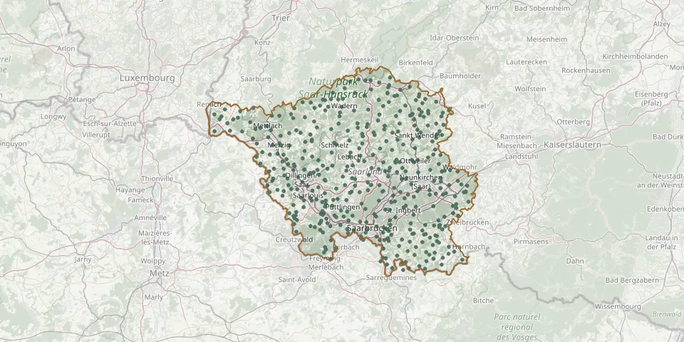 © OpenStreetMap
- Bosen-Eckelhausen Catholic CemeteryGPS coordinates: 49.57306° N, 7.05530° E
- Bosen-Eckelhausen Evangelical CemeteryGPS coordinates: 49.57129° N, 7.05461° E
- Bous CemeteryGPS coordinates: 49.27674° N, 6.80377° E
- Bous Monastery CemeteryGPS coordinates: 49.27264° N, 6.80972° E
- Braunshausen CemeteryGPS coordinates: 49.58143° N, 6.99167° E
- Breitfurt New CemeteryGPS coordinates: 49.19697° N, 7.25334° E
- Breitfurt Old CemeteryGPS coordinates: 49.20082° N, 7.24652° E
- Brenschelbach CemeteryGPS coordinates: 49.15420° N, 7.34325° E
- Britten CemeteryGPS coordinates: 49.51995° N, 6.68318° E
- Brotdorf CemeteryGPS coordinates: 49.47248° N, 6.67635° E
- Bubach CemeteryGPS coordinates: 49.46728° N, 7.26443° E
- Bubach CemeteryGPS coordinates: 49.40322° N, 6.94349° E
- Bübingen CemeteryGPS coordinates: 49.18224° N, 7.03978° E
- Büdingen CemeteryGPS coordinates: 49.44605° N, 6.55196° E
- Burbach Woodland CemeteryGPS coordinates: 49.24987° N, 6.94985° E
- Büschfeld CemeteryGPS coordinates: 49.49591° N, 6.86623° E
- Calmesweiler CemeteryGPS coordinates: 49.41581° N, 6.95079° E
- Derlen Field of Honour Graves 14/18GPS coordinates: 49.28965° N, 6.84236° E
- Derlen Field of Honour Graves 39/45GPS coordinates: 49.29001° N, 6.84216° E
- Diefflen CemeteryGPS coordinates: 49.37223° N, 6.75772° E
- Diefflen Cemetery of HonourGPS coordinates: 49.37414° N, 6.77000° E
- Differten CemeteryGPS coordinates: 49.23640° N, 6.77500° E
- Dillingen Cemetery of HonourGPS coordinates: 49.38093° N, 6.73548° E
- Dillingen Jewish Cemetery / SaarGPS coordinates: 49.36878° N, 6.75266° E
- Dillingen Woodland CemeteryGPS coordinates: 49.38084° N, 6.73353° E
- Dirmingen CemeteryGPS coordinates: 49.41837° N, 6.99879° E
- Dorf im Warndt CemeteryGPS coordinates: 49.18593° N, 6.81407° E
- Dörrenbach CemeteryGPS coordinates: 49.43140° N, 7.23912° E
- Dörsdorf CemeteryGPS coordinates: 49.47032° N, 6.95794° E
- Dreisbach CemeteryGPS coordinates: 49.48565° N, 6.56544° E