
Schleswig-Holstein
612 known cemeteries in Schleswig-Holstein, Germany.
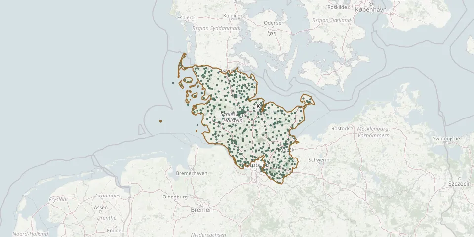 © OpenStreetMap
- Uelsby CemeteryGPS coordinates: 54.63330° N, 9.59610° E
- Uelvesbüll ChurchyardGPS coordinates: 54.41661° N, 8.92067° E
- Uetersen CemeteryGPS coordinates: 53.69434° N, 9.68263° E
- Ulsnis CemeteryGPS coordinates: 54.57380° N, 9.74760° E
- Viöl ChurchyardGPS coordinates: 54.57043° N, 9.18182° E
- Vollerwiek ChurchyardGPS coordinates: 54.29099° N, 8.79459° E
- von Brockdorff-Ahlefeld Family Cemetery, DersauGPS coordinates: 54.13058° N, 10.33390° E
- Voßberg CemeteryGPS coordinates: 54.14694° N, 10.95401° E
- Waabs ChurchyardGPS coordinates: 54.53430° N, 9.98598° E
- Wacken CemeteryGPS coordinates: 54.02161° N, 9.37544° E
- Waldersee Family Burial Site, StöfsGPS coordinates: 54.32100° N, 10.59627° E
- Wanderup CemeteryGPS coordinates: 54.68717° N, 9.33454° E
- Wankendorf CemeteryGPS coordinates: 54.11824° N, 10.21166° E
- Warder CemeteryGPS coordinates: 53.97953° N, 10.37926° E
- Wasbek CemeteryGPS coordinates: 54.07198° N, 9.90548° E
- Weddingstedt ChurchyardGPS coordinates: 54.23905° N, 9.09052° E
- Wedel CemeteryGPS coordinates: 53.59055° N, 9.71520° E
- Wedel Woodland CemeteryGPS coordinates: 53.60115° N, 9.72845° E
- Welt CemeteryGPS coordinates: 54.30195° N, 8.79580° E
- Wentorf Woodland CemeteryGPS coordinates: 53.49650° N, 10.24938° E
- Wenzel HablikGPS coordinates: 54.15906° N, 9.20311° E
- Wesselburen CemeteryGPS coordinates: 54.21165° N, 8.92944° E
- West-Bargum ChurchyardGPS coordinates: 54.70395° N, 8.94706° E
- Westensee ChurchyardGPS coordinates: 54.27599° N, 9.90081° E
- Westerhever ChurchyardGPS coordinates: 54.38209° N, 8.67642° E
- Westerklanxbüll ChurchyardGPS coordinates: 54.86667° N, 8.66431° E
- Westerland Churchyard with Stone WallGPS coordinates: 54.90785° N, 8.31713° E
- Westerrönfeld Jewish CemeteryGPS coordinates: 54.28508° N, 9.65851° E
- Westerrönfeld Municipal CemeteryGPS coordinates: 54.27714° N, 9.64787° E
- Westerthal CemeteryGPS coordinates: 54.46179° N, 9.79080° E