
Thuringia
2,006 known cemeteries in Thuringia, Germany.
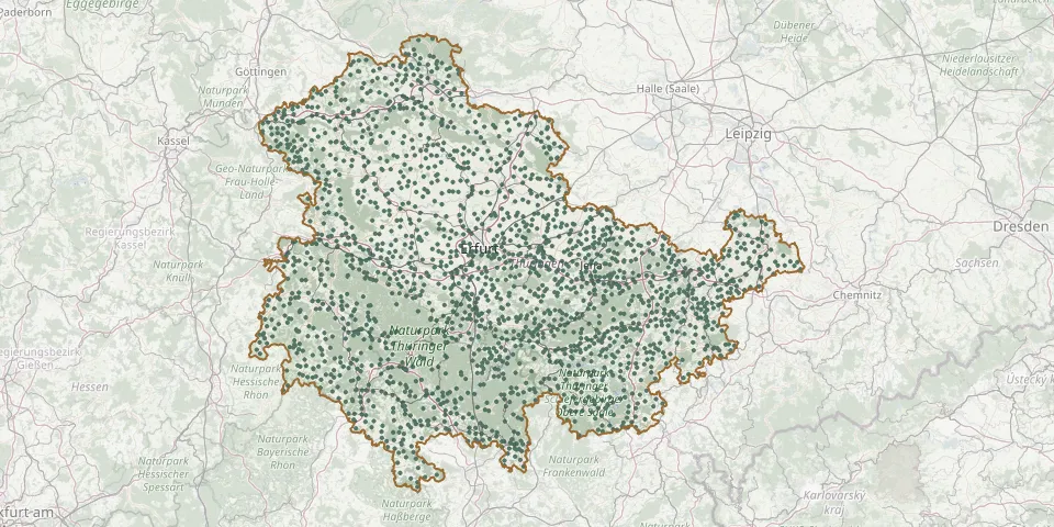 © OpenStreetMap
- Weimar Historic CemeteryGPS coordinates: 50.97461° N, 11.32554° E
- Bad Berka CemeteryGPS coordinates: 50.90216° N, 11.28158° E
- KranichfeldGPS coordinates: 50.85889° N, 11.20103° E
- Blankenhain CemeteryGPS coordinates: 50.86290° N, 11.34358° E
- Apolda Municipal CemeteryGPS coordinates: 51.02273° N, 11.53185° E
- Saint Antoniuskirche WorbisGPS coordinates: 51.41790° N, 10.37050° E
- Ziegenrück CemeteryGPS coordinates: 50.60155° N, 11.65261° E
- Oldisleben Joint CemeteryGPS coordinates: 51.31137° N, 11.16882° E
- BreitenbachGPS coordinates: 51.40501° N, 10.34198° E
- Tannroda CemeteryGPS coordinates: 50.85645° N, 11.25428° E
- Weimar Old CemeteryGPS coordinates: 50.97142° N, 11.32343° E
- Günthersleben CemeteryGPS coordinates: 50.90208° N, 10.76275° E
- Fockendorf CemeteryGPS coordinates: 51.05473° N, 12.45944° E
- Heilbad Heiligenstadt Main CemeteryGPS coordinates: 51.37270° N, 10.12130° E
- Sondershausen Main CemeteryGPS coordinates: 51.37520° N, 10.88450° E
- Finsterbergen CemeteryGPS coordinates: 50.83671° N, 10.59135° E
- Stedten CemeteryGPS coordinates: 50.83793° N, 11.17602° E
- Vippachedelhausen CemeteryGPS coordinates: 51.08152° N, 11.21117° E
- Heldrungen CemeteryGPS coordinates: 51.30438° N, 11.22241° E
- Kallmerode CemeteryGPS coordinates: 51.35289° N, 10.30775° E
- Hachelbich CemeteryGPS coordinates: 51.34301° N, 10.96782° E
- Barchfeld CemeteryGPS coordinates: 50.82947° N, 11.17519° E
- Friesau CemeteryGPS coordinates: 50.49847° N, 11.64226° E
- St. James Cemetery, StadtrodaGPS coordinates: 50.85999° N, 11.72722° E
- St. James Cemetery, WeimarGPS coordinates: 50.98339° N, 11.32752° E
- Kirchworbis CemeteryGPS coordinates: 51.40774° N, 10.39922° E
- Konsul's GrabGPS coordinates: 51.18558° N, 10.20356° E
- Röhrig CemeteryGPS coordinates: 51.33474° N, 10.04031° E
- Abtsbessingen CemeteryGPS coordinates: 51.26232° N, 10.75962° E
- Achelstädt CemeteryGPS coordinates: 50.83735° N, 11.12051° E