
Thuringia
2,006 known cemeteries in Thuringia, Germany.
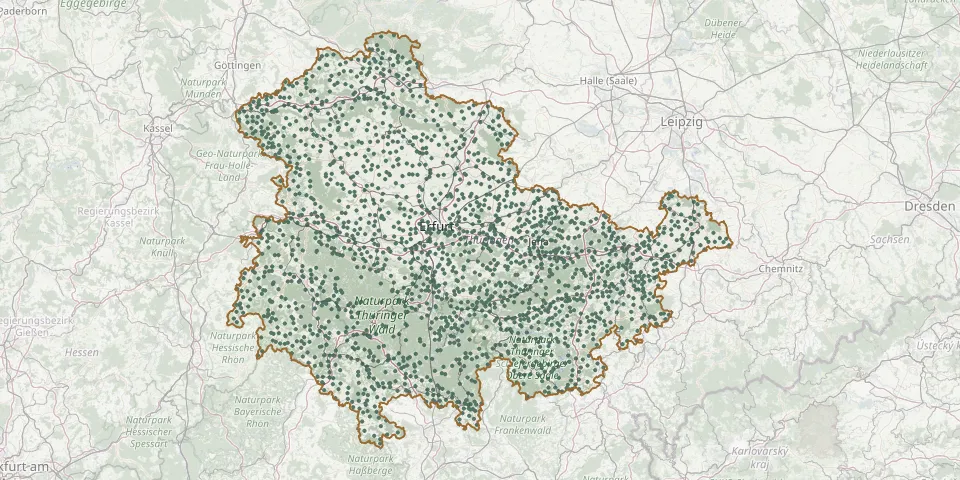 © OpenStreetMap
- Andisleben CemeteryGPS coordinates: 51.08365° N, 10.92832° E
- Angelhausen CemeteryGPS coordinates: 50.82594° N, 10.96748° E
- Angelroda CemeteryGPS coordinates: 50.74596° N, 10.86554° E
- Angstedt CemeteryGPS coordinates: 50.69864° N, 11.02208° E
- Apfelstädt CemeteryGPS coordinates: 50.90054° N, 10.88734° E
- Appenrode CemeteryGPS coordinates: 51.57413° N, 10.73090° E
- Arenshausen CemeteryGPS coordinates: 51.37361° N, 9.97057° E
- Arlesberger CemeteryGPS coordinates: 50.71659° N, 10.82061° E
- Arnsgrün Cemetery, Zeulenroda-TriebesGPS coordinates: 50.58073° N, 12.07359° E
- Arnshaugk CemeteryGPS coordinates: 50.72804° N, 11.75325° E
- Arnstadt Main CemeteryGPS coordinates: 50.83868° N, 10.96297° E
- Artern Park CemeteryGPS coordinates: 51.37224° N, 11.28560° E
- Asbach CemeteryGPS coordinates: 50.72501° N, 10.48753° E
- Asbach CemeteryGPS coordinates: 51.28118° N, 10.03088° E
- Aschara CemeteryGPS coordinates: 51.05802° N, 10.68368° E
- Aschegrab 1944/45GPS coordinates: 51.01468° N, 11.24515° E
- Aschenhausen CemeteryGPS coordinates: 50.59776° N, 10.19704° E
- Aschenhausen Jewish CemeteryGPS coordinates: 50.59906° N, 10.19667° E
- Aspach Cemetery (Thüringen)GPS coordinates: 50.95233° N, 10.59470° E
- Aubachtal CemeteryGPS coordinates: 50.65585° N, 12.22765° E
- Aue CemeteryGPS coordinates: 50.72300° N, 10.42603° E
- Auerstedt CemeteryGPS coordinates: 51.10103° N, 11.58689° E
- Auleben CemeteryGPS coordinates: 51.42604° N, 10.93648° E
- Azmannsdorf CemeteryGPS coordinates: 50.98781° N, 11.10782° E
- Bach Church Churchyard, ArnstadtGPS coordinates: 50.83419° N, 10.94648° E
- Bachfeld CemeteryGPS coordinates: 50.41034° N, 10.97699° E
- Bachra Cemetery (Rastenberg)GPS coordinates: 51.19761° N, 11.36300° E
- Backleben CemeteryGPS coordinates: 51.19758° N, 11.28486° E
- Bad Blankenburg CemeteryGPS coordinates: 50.68706° N, 11.27770° E
- Bad Frankenhausen CemeteryGPS coordinates: 51.35822° N, 11.10792° E