
Thuringia
2,006 known cemeteries in Thuringia, Germany.
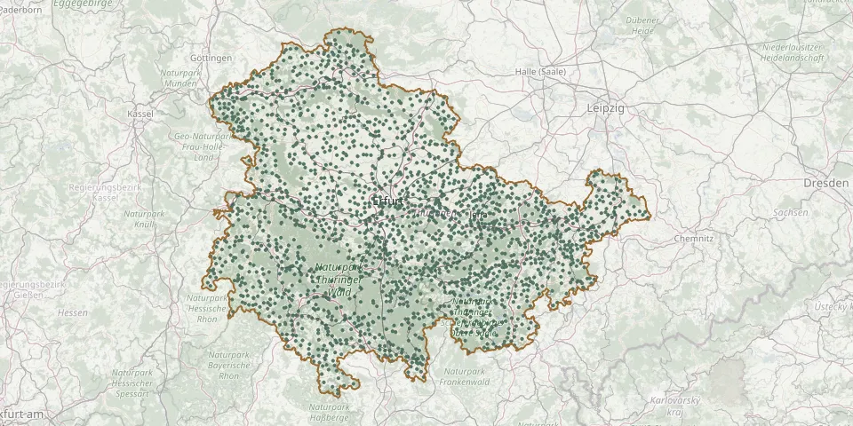 © OpenStreetMap
- Günserode CemeteryGPS coordinates: 51.31082° N, 11.04971° E
- Günstedt CemeteryGPS coordinates: 51.22356° N, 11.08538° E
- Günterode CemeteryGPS coordinates: 51.42341° N, 10.16722° E
- Günzerode CemeteryGPS coordinates: 51.52166° N, 10.65962° E
- Gutendorf CemeteryGPS coordinates: 50.92144° N, 11.21140° E
- Guthmannshausen CemeteryGPS coordinates: 51.13321° N, 11.36664° E
- Haarhausen CemeteryGPS coordinates: 50.86360° N, 10.89871° E
- Haferungen CemeteryGPS coordinates: 51.50880° N, 10.65616° E
- Haina Cemetery (Nessetal)GPS coordinates: 50.99073° N, 10.51811° E
- Haina Cemetery (Römhild)GPS coordinates: 50.41621° N, 10.54405° E
- Hainbücht CemeteryGPS coordinates: 50.86604° N, 11.71374° E
- Hain CemeteryGPS coordinates: 51.43316° N, 10.78731° E
- Haindorf CemeteryGPS coordinates: 50.71664° N, 10.41343° E
- Haindorf Cemetery (Am Ettersberg)GPS coordinates: 51.08866° N, 11.32175° E
- Hainichen CemeteryGPS coordinates: 50.99535° N, 11.62465° E
- Hainrode CemeteryGPS coordinates: 51.41599° N, 10.69780° E
- Hainspitz CemeteryGPS coordinates: 50.96465° N, 11.84120° E
- Hallungen CemeteryGPS coordinates: 51.13502° N, 10.33197° E
- Hamma CemeteryGPS coordinates: 51.42832° N, 10.89590° E
- Hanstein CemeteryGPS coordinates: 51.35662° N, 9.98453° E
- Hardisleben CemeteryGPS coordinates: 51.15961° N, 11.42248° E
- Harra CemeteryGPS coordinates: 50.40435° N, 11.71717° E
- Harra CemeteryGPS coordinates: 50.41765° N, 11.67927° E
- Harras CemeteryGPS coordinates: 50.40786° N, 10.85975° E
- Harras CemeteryGPS coordinates: 51.27138° N, 11.23374° E
- Hartmannsdorf CemeteryGPS coordinates: 50.96316° N, 11.97703° E
- Hartmannsdorf CemeteryGPS coordinates: 50.90930° N, 12.00240° E
- Hartroda CemeteryGPS coordinates: 50.91806° N, 12.24635° E
- Harzungen CemeteryGPS coordinates: 51.55639° N, 10.81326° E
- Haselbach CemeteryGPS coordinates: 50.82806° N, 12.23827° E