
Thuringia
2,006 known cemeteries in Thuringia, Germany.
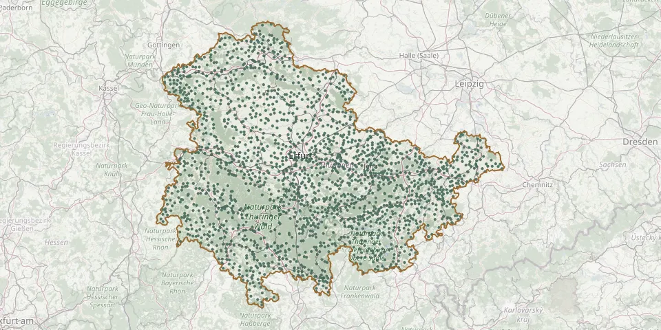 © OpenStreetMap
- Heyerode New CemeteryGPS coordinates: 51.16090° N, 10.32318° E
- Heyerode Old CemeteryGPS coordinates: 51.16224° N, 10.32337° E
- Heyersdorf CemeteryGPS coordinates: 50.84764° N, 12.35475° E
- Heygendorf CemeteryGPS coordinates: 51.35305° N, 11.36541° E
- Hilbersdorf CemeteryGPS coordinates: 50.82014° N, 12.14958° E
- Hildburghausen CemeteryGPS coordinates: 50.43342° N, 10.73267° E
- Hildebrandshausen CemeteryGPS coordinates: 51.19890° N, 10.22040° E
- Himmelsberg CemeteryGPS coordinates: 51.33459° N, 10.73172° E
- Hindfeld CemeteryGPS coordinates: 50.36733° N, 10.56413° E
- Hinternah CemeteryGPS coordinates: 50.51936° N, 10.79219° E
- Hirschbach Cemetery (Schleusingen)GPS coordinates: 50.56357° N, 10.73720° E
- Hirschberg CemeteryGPS coordinates: 50.41169° N, 11.81095° E
- Hirschendorf CemeteryGPS coordinates: 50.45507° N, 10.91506° E
- Hirschfeld 16GPS coordinates: 50.94144° N, 12.18858° E
- Hirschroda CemeteryGPS coordinates: 51.02281° N, 11.65877° E
- Hochdorf Cemetery (Blankenhain)GPS coordinates: 50.82652° N, 11.32212° E
- Hochheim CemeteryGPS coordinates: 50.95540° N, 10.99360° E
- Hochheim CemeteryGPS coordinates: 51.01786° N, 10.65981° E
- Hochstedt CemeteryGPS coordinates: 50.98394° N, 11.13840° E
- Hochstedt CemeteryGPS coordinates: 51.52205° N, 10.69921° E
- Hohenbergen CemeteryGPS coordinates: 51.21947° N, 10.63375° E
- Hohenebra CemeteryGPS coordinates: 51.30571° N, 10.81963° E
- Hoheneiche CemeteryGPS coordinates: 50.58997° N, 11.28891° E
- Hohenfelden CemeteryGPS coordinates: 50.87945° N, 11.16010° E
- Hohengandern CemeteryGPS coordinates: 51.37071° N, 9.94508° E
- Hohenkirchen Cemetery, GeorgenthalGPS coordinates: 50.85160° N, 10.70297° E
- Hohenleuben CemeteryGPS coordinates: 50.70826° N, 12.05368° E
- Hohenölsen CemeteryGPS coordinates: 50.73658° N, 12.08205° E
- Hohenwarte CemeteryGPS coordinates: 50.60769° N, 11.47501° E
- Hohleborn Cemetery, Floh-SeligenthalGPS coordinates: 50.77529° N, 10.46972° E