
Thuringia
2,006 known cemeteries in Thuringia, Germany.
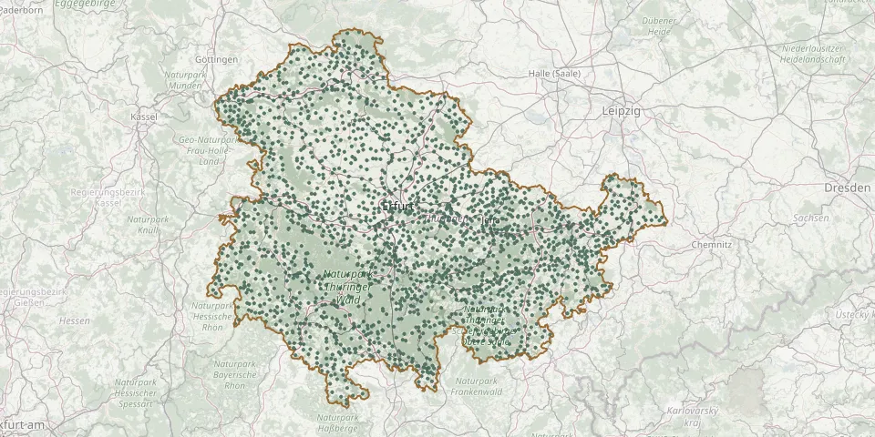 © OpenStreetMap
- Kaatschen CemeteryGPS coordinates: 51.09733° N, 11.68465° E
- Kahla Evangelical Lutheran Parish CemeteryGPS coordinates: 50.80196° N, 11.57949° E
- Kahmer CemeteryGPS coordinates: 50.65681° N, 12.28502° E
- Kälberfeld CemeteryGPS coordinates: 50.94115° N, 10.46015° E
- Kalbsrieth CemeteryGPS coordinates: 51.34078° N, 11.33737° E
- Kaltenborn CemeteryGPS coordinates: 50.78827° N, 10.22922° E
- Kalteneber CemeteryGPS coordinates: 51.32021° N, 10.13855° E
- Kaltenlengsfeld CemeteryGPS coordinates: 50.64098° N, 10.19335° E
- Kaltennordheim CemeteryGPS coordinates: 50.62696° N, 10.15406° E
- Kaltensundheim CemeteryGPS coordinates: 50.60746° N, 10.15990° E
- Kaltenwestheim CemeteryGPS coordinates: 50.60851° N, 10.11814° E
- Kammerforst CemeteryGPS coordinates: 51.12390° N, 10.42555° E
- Kammerforst Old CemeteryGPS coordinates: 51.12329° N, 10.42898° E
- Kamsdorf CemeteryGPS coordinates: 50.64554° N, 11.45460° E
- Kannawurf CemeteryGPS coordinates: 51.27106° N, 11.13240° E
- Kapellendorf CemeteryGPS coordinates: 50.97455° N, 11.46938° E
- Käßlitz CemeteryGPS coordinates: 50.22176° N, 10.71693° E
- Katharinenberg CemeteryGPS coordinates: 51.18053° N, 10.25922° E
- Katzberg CemeteryGPS coordinates: 50.39591° N, 10.97640° E
- Katzhütte CemeteryGPS coordinates: 50.54783° N, 11.04895° E
- Kaulsdorf CemeteryGPS coordinates: 50.62137° N, 11.43273° E
- Kefferhausen CemeteryGPS coordinates: 51.31220° N, 10.28270° E
- Kehmstedt CemeteryGPS coordinates: 51.47521° N, 10.61489° E
- Keila CemeteryGPS coordinates: 50.63703° N, 11.66093° E
- Keilhau CemeteryGPS coordinates: 50.71304° N, 11.24855° E
- Keilhau Historic CemeteryGPS coordinates: 50.71613° N, 11.24975° E
- Kella CemeteryGPS coordinates: 51.22802° N, 10.08073° E
- Kerspleben CemeteryGPS coordinates: 51.00587° N, 11.10021° E
- Keßlar CemeteryGPS coordinates: 50.83858° N, 11.41862° E
- Ketten Cemetery, GeisaGPS coordinates: 50.64546° N, 9.92935° E