
Thuringia
2,006 known cemeteries in Thuringia, Germany.
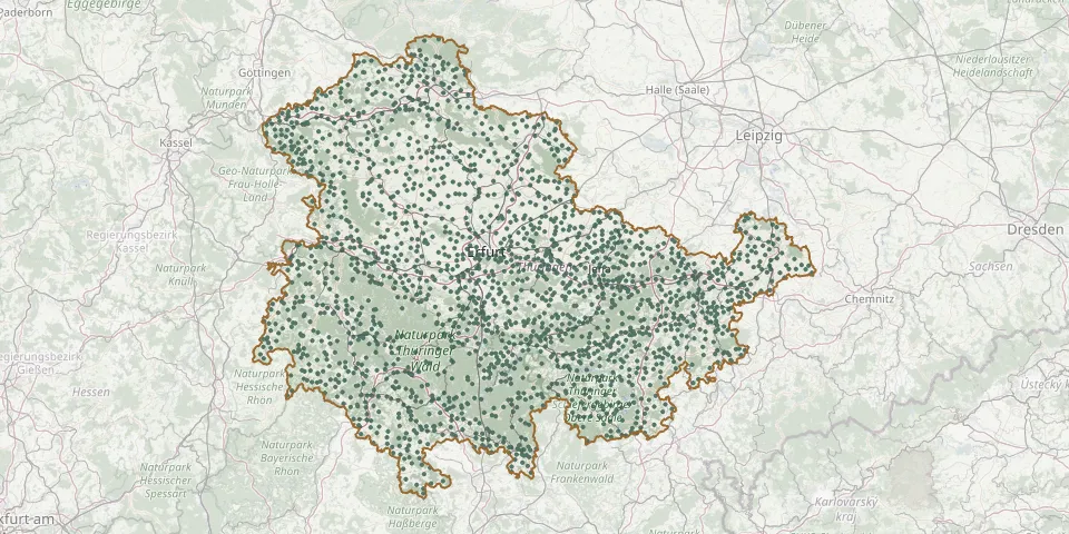 © OpenStreetMap
- Stepfershausen CemeteryGPS coordinates: 50.59395° N, 10.30015° E
- Steudnitz CemeteryGPS coordinates: 51.00968° N, 11.69715° E
- Stiebritz CemeteryGPS coordinates: 50.99807° N, 11.60550° E
- St. Jacob CemeteryGPS coordinates: 50.58574° N, 11.47742° E
- St. Kilian CemeteryGPS coordinates: 50.52940° N, 10.76112° E
- St. Martini CemeteryGPS coordinates: 51.15048° N, 10.56896° E
- St. MartinskircheGPS coordinates: 50.95547° N, 11.63566° E
- St. Nicholas Churchyard, WeißenseeGPS coordinates: 51.19793° N, 11.06324° E
- Stobra CemeteryGPS coordinates: 51.00658° N, 11.56231° E
- Stöckey CemeteryGPS coordinates: 51.53536° N, 10.49730° E
- Stockhausen CemeteryGPS coordinates: 51.38353° N, 10.84206° E
- Stockhausen Municipal CemeteryGPS coordinates: 50.99087° N, 10.37630° E
- Stotterhain Memorial CemeteryGPS coordinates: 50.86425° N, 10.74999° E
- Stotternheim CemeteryGPS coordinates: 51.05484° N, 11.04180° E
- Straußberg CemeteryGPS coordinates: 51.38760° N, 10.74884° E
- Straußfurt CemeteryGPS coordinates: 51.17206° N, 10.99240° E
- Stregda Cemetery, EisenachGPS coordinates: 51.00262° N, 10.31278° E
- Streitholz CemeteryGPS coordinates: 51.41489° N, 10.09205° E
- Stressenhausen CemeteryGPS coordinates: 50.38345° N, 10.70072° E
- Streufdorf CemeteryGPS coordinates: 50.35145° N, 10.68729° E
- Strößwitz CemeteryGPS coordinates: 50.77216° N, 11.75183° E
- Struth CemeteryGPS coordinates: 51.22253° N, 10.30673° E
- Struth Cemetery (Harth-Pöllnitz)GPS coordinates: 50.77361° N, 11.95081° E
- Struth-Helmershof CemeteryGPS coordinates: 50.74856° N, 10.50845° E
- St. Stephanus CemeteryGPS coordinates: 51.21420° N, 10.16460° E
- Stützerbach CemeteryGPS coordinates: 50.63853° N, 10.85684° E
- St. Walpurga Cemetery (Großengottern)GPS coordinates: 51.14734° N, 10.55801° E
- Suhl Jewish CemeteryGPS coordinates: 50.59369° N, 10.66262° E
- Suhl Jewish CemeteryGPS coordinates: 50.60400° N, 10.69422° E
- Suhl Main CemeteryGPS coordinates: 50.60469° N, 10.69543° E