
Thuringia
2,006 known cemeteries in Thuringia, Germany.
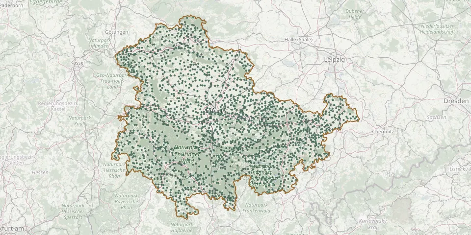 © OpenStreetMap
- Wahlhausen CemeteryGPS coordinates: 51.29608° N, 9.98131° E
- Wahlwinkel CemeteryGPS coordinates: 50.89833° N, 10.60370° E
- Wahns CemeteryGPS coordinates: 50.63040° N, 10.30379° E
- Waldau CemeteryGPS coordinates: 50.49894° N, 10.82054° E
- Waldhaus Upper Woodland CemeteryGPS coordinates: 50.39565° N, 10.59579° E
- Waldstedt CemeteryGPS coordinates: 51.09729° N, 10.57577° E
- Wallbach Cemetery, MeiningenGPS coordinates: 50.63002° N, 10.39453° E
- Walldorf CemeteryGPS coordinates: 50.61413° N, 10.38512° E
- Walldorf Jewish CemeteryGPS coordinates: 50.61539° N, 10.38325° E
- Wallendorf CemeteryGPS coordinates: 50.52441° N, 11.19333° E
- Wallichen CemeteryGPS coordinates: 51.01077° N, 11.15164° E
- Wallrabs CemeteryGPS coordinates: 50.42217° N, 10.70899° E
- Walpernhain CemeteryGPS coordinates: 51.01559° N, 11.94630° E
- Walschleben CemeteryGPS coordinates: 51.06546° N, 10.93364° E
- Waltersdorf CemeteryGPS coordinates: 50.85061° N, 11.93415° E
- Waltersdorf CemeteryGPS coordinates: 50.72398° N, 12.19269° E
- Waltersdorf Cemetery (Weißensee)GPS coordinates: 51.22058° N, 11.11542° E
- Waltershausen CemeteryGPS coordinates: 50.89967° N, 10.55164° E
- Waltersleben CemeteryGPS coordinates: 50.91707° N, 11.02333° E
- Wandersleben CemeteryGPS coordinates: 50.89710° N, 10.85441° E
- Wartha Cemetery (Eisenach)GPS coordinates: 50.99612° N, 10.20486° E
- Warza CemeteryGPS coordinates: 50.99546° N, 10.68969° E
- Wasserthaleben CemeteryGPS coordinates: 51.25968° N, 10.89670° E
- Wasungen CemeteryGPS coordinates: 50.65920° N, 10.37431° E
- Watzdorf Cemetery (Bad Blankenburg)GPS coordinates: 50.68978° N, 11.23512° E
- Weberstedt CemeteryGPS coordinates: 51.10864° N, 10.51623° E
- Wechmar CemeteryGPS coordinates: 50.89119° N, 10.77429° E
- Wehnde CemeteryGPS coordinates: 51.48347° N, 10.31288° E
- Wehrkirche HausenGPS coordinates: 50.80868° N, 11.01082° E
- Weida CemeteryGPS coordinates: 50.77841° N, 12.05569° E