
Guanajuato
64 known cemeteries in Guanajuato, Mexico.
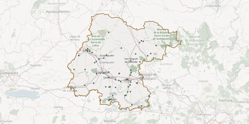 © OpenStreetMap
- Abasolo Municipal CemeteryGPS coordinates: 20.46023° N, 101.53668° W
- Acámbaro Municipal CemeteryGPS coordinates: 20.02428° N, 100.72634° W
- Apaseo el Alto New Municipal CemeteryGPS coordinates: 20.46366° N, 100.61100° W
- Apaseo el Alto Old Municipal CemeteryGPS coordinates: 20.45880° N, 100.62546° W
- Benito Juárez Municipal CemeteryGPS coordinates: 20.00454° N, 100.52079° W
- Campo Florido Municipal CemeteryGPS coordinates: 20.38532° N, 101.18564° W
- Castillo CemeteryGPS coordinates: 20.57222° N, 100.49225° W
- Cerano Cemetery (San Juan Cerano)GPS coordinates: 20.11842° N, 101.38879° W
- Comonfort Municipal Cemetery 2GPS coordinates: 20.72090° N, 100.74885° W
- Coroneo Municipal CemeteryGPS coordinates: 20.20123° N, 100.36868° W
- Dolores Cemetery, Empalme EscobedoGPS coordinates: 20.66984° N, 100.74192° W
- Dolores Hidalgo Municipal CemeteryGPS coordinates: 21.15649° N, 100.95081° W
- Dolores Municipal Cemetery, MoroleónGPS coordinates: 20.12936° N, 101.20030° W
- El Capulín CemeteryGPS coordinates: 21.04874° N, 100.32805° W
- Eternal Gardens of Silao CemeteryGPS coordinates: 20.93571° N, 101.42394° W
- Guadalupana CemeteryGPS coordinates: 20.21143° N, 101.13739° W
- Hermanito CemeteryGPS coordinates: 20.49158° N, 100.96523° W
- Irapuato Municipal CemeteryGPS coordinates: 20.65943° N, 101.32236° W
- Jaral del Progreso Municipal CemeteryGPS coordinates: 20.37331° N, 101.07420° W
- Jardines del Tiempo Cemetery, LeónGPS coordinates: 21.09286° N, 101.61904° W
- Juan Martín Cemetery near CelayaGPS coordinates: 20.48055° N, 100.75242° W
- Juventino Rosas North Municipal CemeteryGPS coordinates: 20.65516° N, 100.99453° W
- Juventino Rosas Old CemeteryGPS coordinates: 20.64858° N, 100.99916° W
- La Moncada CemeteryGPS coordinates: 20.28542° N, 100.81630° W
- Las Flores Cemetery, SalamancaGPS coordinates: 20.57682° N, 101.21424° W
- León Gardens CemeteryGPS coordinates: 21.14507° N, 101.66384° W
- Los Rodríguez CemeteryGPS coordinates: 21.04015° N, 100.64788° W
- Manuel Doblado Municipal CemeteryGPS coordinates: 20.73348° N, 101.95196° W
- Mexicanos CemeteryGPS coordinates: 20.52841° N, 101.07294° W
- Misión de Chichimecas Community CemeteryGPS coordinates: 21.29113° N, 100.48469° W