
Guanajuato
64 known cemeteries in Guanajuato, Mexico.
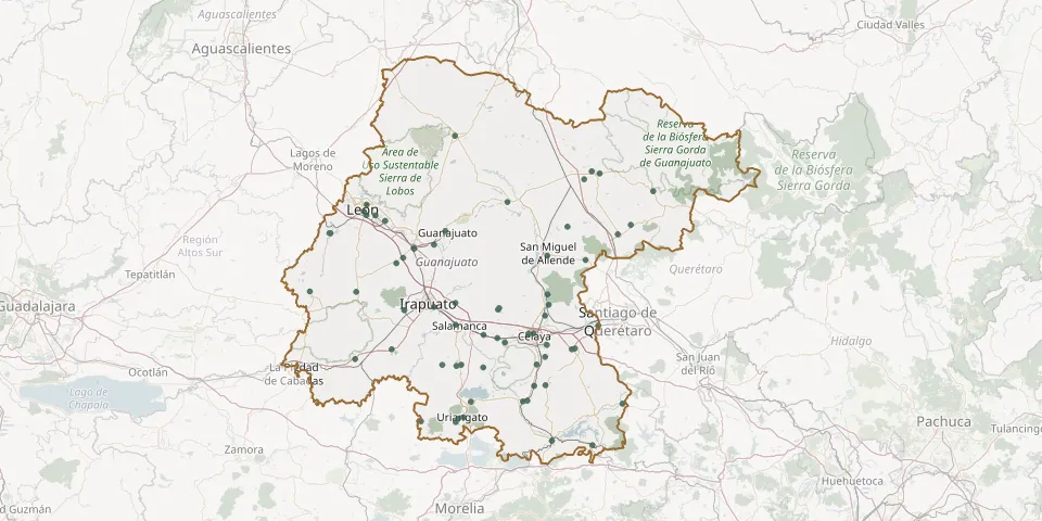 © OpenStreetMap
- Moroleón Municipal Cemetery IIGPS coordinates: 20.11369° N, 101.21360° W
- Norte Municipal CemeteryGPS coordinates: 20.53438° N, 100.82011° W
- Nuestra Señora de la Luz CemeteryGPS coordinates: 21.06739° N, 101.57004° W
- Ojo Seco CemeteryGPS coordinates: 20.38700° N, 100.80244° W
- Our Lady Guadalupe CemeteryGPS coordinates: 20.90318° N, 100.75019° W
- Pénjamo Municipal CemeteryGPS coordinates: 20.41398° N, 101.72150° W
- Rancho Nuevo de San Andrés CemeteryGPS coordinates: 20.38621° N, 101.28140° W
- Rincón de Tamayo CemeteryGPS coordinates: 20.42317° N, 100.76150° W
- Romita Municipal CemeteryGPS coordinates: 20.86682° N, 101.51297° W
- San Cristóbal Cemetery near IrapuatoGPS coordinates: 20.64501° N, 101.47423° W
- San Felipe Municipal CemeteryGPS coordinates: 21.46822° N, 101.21779° W
- San Francisco del Rincón Municipal CemeteryGPS coordinates: 21.00966° N, 101.85222° W
- San José de Mendoza CemeteryGPS coordinates: 20.67929° N, 101.21484° W
- San José Iturbide Municipal CemeteryGPS coordinates: 21.00497° N, 100.39379° W
- San Juan de la Puerta CemeteryGPS coordinates: 20.73232° N, 101.71674° W
- San Juan de la Vega CemeteryGPS coordinates: 20.61937° N, 100.76166° W
- San Luis de la Paz Municipal CemeteryGPS coordinates: 21.30142° N, 100.52432° W
- San Miguel Cemetery, San Francisco del RincónGPS coordinates: 21.00999° N, 101.84669° W
- San Nicolás Cemetery, LeónGPS coordinates: 21.11232° N, 101.67801° W
- San Nicolás del Carmen Municipal CemeteryGPS coordinates: 21.26332° N, 100.56322° W
- San Sebastián CemeteryGPS coordinates: 21.09431° N, 101.66519° W
- Santa Paula Municipal CemeteryGPS coordinates: 21.02012° N, 101.26584° W
- Santas Marías CemeteryGPS coordinates: 20.88310° N, 100.55670° W
- Santa Teresa CemeteryGPS coordinates: 20.95425° N, 101.32288° W
- Señor Santiago Municipal CemeteryGPS coordinates: 20.38069° N, 101.20914° W
- Silao Inner CemeteryGPS coordinates: 20.93881° N, 101.42620° W
- Silao Village CemeteryGPS coordinates: 20.89352° N, 101.47893° W
- Tarimoro Municipal Cemetery No. 1 (Old Cemetery)GPS coordinates: 20.28988° N, 100.75980° W
- Uriangato Municipal CemeteryGPS coordinates: 20.13687° N, 101.17253° W
- Urireo CemeteryGPS coordinates: 20.21518° N, 100.84993° W