
Jalisco
153 known cemeteries in Jalisco, Mexico.
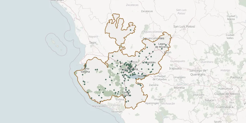 © OpenStreetMap
- El Salto New Municipal CemeteryGPS coordinates: 20.51534° N, 103.19235° W
- El Tuito Municipal CemeteryGPS coordinates: 20.32121° N, 105.33289° W
- El Tule Ejido CemeteryGPS coordinates: 20.02541° N, 105.24902° W
- Emiliano Zapata Ejido CemeteryGPS coordinates: 19.37585° N, 104.95321° W
- Encarnación de Díaz Municipal CemeteryGPS coordinates: 21.53192° N, 102.23711° W
- Eternal Rest of Loved Ones Cemetery, PihuamoGPS coordinates: 19.22781° N, 103.46656° W
- Etzatlán Municipal CemeteryGPS coordinates: 20.76815° N, 104.07073° W
- Father Silvano López Correa Municipal Cemetery, San Sebastián del SurGPS coordinates: 19.79553° N, 103.46614° W
- Fray Antonio de Segovia Municipal Cemetery, TuxpanGPS coordinates: 19.54931° N, 103.37072° W
- Guadalajara CemeteryGPS coordinates: 20.70566° N, 103.30620° W
- Guadalajara Garden CemeteryGPS coordinates: 20.61336° N, 103.38381° W
- Guadalupe CemeteryGPS coordinates: 22.10466° N, 103.27935° W
- Hacienda de Guadalupe New Municipal CemeteryGPS coordinates: 20.84825° N, 103.24079° W
- Hostotipaquillo Municipal CemeteryGPS coordinates: 21.06543° N, 104.04936° W
- Huentitán El Alto CemeteryGPS coordinates: 20.72552° N, 103.29983° W
- Ixtlahuacán CemeteryGPS coordinates: 20.86591° N, 103.23476° W
- Ixtlahuacán de los Membrillos Municipal CemeteryGPS coordinates: 20.35548° N, 103.19120° W
- Jalostotitlán Municipal CemeteryGPS coordinates: 21.17278° N, 102.46547° W
- Jamay Municipal CemeteryGPS coordinates: 20.29253° N, 102.70037° W
- Jesús María y José Private Cemetery, San Juan de los LagosGPS coordinates: 21.24200° N, 102.32180° W
- Jocotepec Municipal CemeteryGPS coordinates: 20.28730° N, 103.43888° W
- Juan Pablo II Cemetery near El ZapotilloGPS coordinates: 19.60858° N, 104.46337° W
- Juchitlan CemeteryGPS coordinates: 20.08769° N, 104.08913° W
- La Calera CemeteryGPS coordinates: 20.45199° N, 103.25090° W
- La Candelaria Cemetery, Villa PurificaciónGPS coordinates: 19.70347° N, 104.61533° W
- La Purísima Cemetery, Joya GrandeGPS coordinates: 20.70527° N, 103.04390° W
- La Sagrada Familia CemeteryGPS coordinates: 19.48450° N, 104.63045° W
- La Soledad CemeteryGPS coordinates: 21.35866° N, 101.93926° W
- La Venta del Astillero Municipal CemeteryGPS coordinates: 20.72364° N, 103.54236° W
- Lomas de Tejeda CemeteryGPS coordinates: 20.46963° N, 103.41434° W