
Jalisco
153 known cemeteries in Jalisco, Mexico.
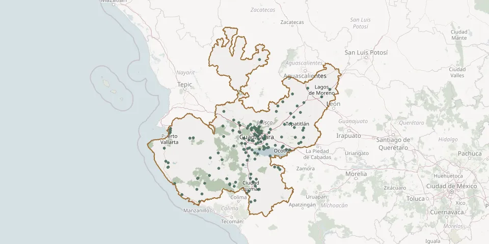 © OpenStreetMap
- San Lucas Evangelista CemeteryGPS coordinates: 20.40755° N, 103.35590° W
- San Luis Soyatlán CemeteryGPS coordinates: 20.20549° N, 103.31782° W
- San Marcos Evangelista CemeteryGPS coordinates: 20.31233° N, 103.53051° W
- San Marcos Municipal CemeteryGPS coordinates: 19.44792° N, 103.50980° W
- San Martín de las Flores Municipal CemeteryGPS coordinates: 20.59838° N, 103.27886° W
- San Miguel CemeteryGPS coordinates: 20.54070° N, 102.50612° W
- San Miguel del Cuarenta CemeteryGPS coordinates: 21.50815° N, 101.76182° W
- San Miguel El Alto Municipal CemeteryGPS coordinates: 21.04238° N, 102.39708° W
- San Pedrito Municipal CemeteryGPS coordinates: 20.62130° N, 103.28074° W
- San Pedro Tlaquepaque CemeteryGPS coordinates: 20.64520° N, 103.31480° W
- San Sebastianito Municipal CemeteryGPS coordinates: 20.59377° N, 103.38301° W
- Santa Cruz de las Flores CemeteryGPS coordinates: 20.48649° N, 103.50968° W
- Santa Cruz de las Huertas Municipal CemeteryGPS coordinates: 20.62391° N, 103.26622° W
- Santa Cruz de la Soledad CemeteryGPS coordinates: 20.32266° N, 103.15794° W
- Santa Martha Ejido CemeteryGPS coordinates: 19.60216° N, 105.11099° W
- Santa Rita CemeteryGPS coordinates: 20.43983° N, 102.38514° W
- Santa Rosa CemeteryGPS coordinates: 20.56054° N, 103.32121° W
- Santo Domingo Municipal CemeteryGPS coordinates: 20.71864° N, 105.19660° W
- Senderos de vista hermosa CemeteryGPS coordinates: 19.69258° N, 103.34963° W
- Tala Municipal CemeteryGPS coordinates: 20.64134° N, 103.70286° W
- Tala Municipal Cemetery No. 2GPS coordinates: 20.65237° N, 103.71647° W
- Tecalitlán Municipal CemeteryGPS coordinates: 19.47991° N, 103.29972° W
- Techaluta de Montenegro CemeteryGPS coordinates: 20.07532° N, 103.54713° W
- Tenamaxtlán CemeteryGPS coordinates: 20.22547° N, 104.16885° W
- Teocuitatlán Municipal CemeteryGPS coordinates: 20.10064° N, 103.37749° W
- Tepatitlán de Morelos Municipality New Municipal CemeteryGPS coordinates: 20.80196° N, 102.73638° W
- Tepec Municipal CemeteryGPS coordinates: 19.98307° N, 103.63570° W
- Tequesquite Ejido CemeteryGPS coordinates: 20.05593° N, 105.30071° W
- Tequesquitlán Municipal CemeteryGPS coordinates: 19.38900° N, 104.52162° W
- Tequila Municipal CemeteryGPS coordinates: 20.88911° N, 103.83423° W