
Gelderland
475 known cemeteries in Gelderland, Netherlands.
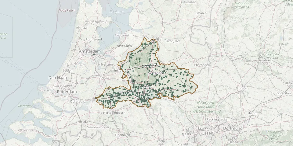 © OpenStreetMap
- Winterswijk Jewish CemeteryGPS coordinates: 51.96857° N, 6.71730° E
- Winterswijk Old CemeteryGPS coordinates: 51.97428° N, 6.72315° E
- Winterswijk Roman Catholic CemeteryGPS coordinates: 51.97257° N, 6.71177° E
- Wisch (Varsseveld) General CemeteryGPS coordinates: 51.94021° N, 6.46323° E
- Wolfheze Foundation Cemetery of Gelderse RoosGPS coordinates: 52.00040° N, 5.78394° E
- Zaltbommel General CemeteryGPS coordinates: 51.82458° N, 5.21036° E
- Zaltbommel Jewish CemeteryGPS coordinates: 51.81042° N, 5.25119° E
- Zaltbommel Jewish CemeteryGPS coordinates: 51.80854° N, 5.24691° E
- Zaltbommel Jewish CemeteryGPS coordinates: 51.81049° N, 5.24615° E
- Zaltbommel Old General CemeteryGPS coordinates: 51.81027° N, 5.25038° E
- Zaltbommel War CemeteryGPS coordinates: 51.81152° N, 5.25778° E
- Zeddam Roman Catholic CemeteryGPS coordinates: 51.90301° N, 6.26266° E
- Zennewijnen General CemeteryGPS coordinates: 51.85422° N, 5.40328° E
- Zevenaar Jewish CemeteryGPS coordinates: 51.93097° N, 6.08263° E
- Zevenaar Protestant CemeteryGPS coordinates: 51.92512° N, 6.08150° E
- Zevenaar Roman Catholic CemeteryGPS coordinates: 51.92897° N, 6.07323° E
- Zieuwent Roman Catholic CemeteryGPS coordinates: 52.00310° N, 6.51250° E
- Zoelen CemeteryGPS coordinates: 51.90683° N, 5.40491° E
- Zoelen en Kerk-Avezaath General CemeteryGPS coordinates: 51.90589° N, 5.38881° E
- Zoelmond CemeteryGPS coordinates: 51.94292° N, 5.31121° E
- Zuiderzeestraatweg-West CemeteryGPS coordinates: 52.42830° N, 5.82945° E
- Zuilichem General CemeteryGPS coordinates: 51.80604° N, 5.13545° E
- Zutphen East CemeteryGPS coordinates: 52.15201° N, 6.23125° E
- Zutphen General CemeteryGPS coordinates: 52.14363° N, 6.21324° E
- Zutphen Jewish CemeteryGPS coordinates: 52.12965° N, 6.20502° E