
Gelderland
475 known cemeteries in Gelderland, Netherlands.
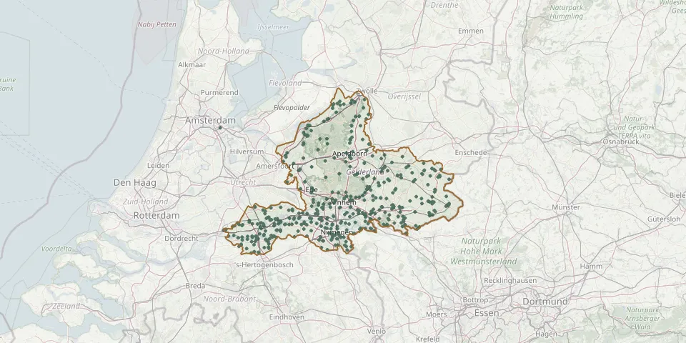 © OpenStreetMap
- St. Martinus CemeteryGPS coordinates: 51.99551° N, 6.07282° E
- Stokkum CemeteryGPS coordinates: 51.88048° N, 6.22274° E
- St. Paschal Baylon Church Cemetery, WijchenGPS coordinates: 51.82127° N, 5.73674° E
- St. Werenfrid Roman Catholic Churchyard, WestervoortGPS coordinates: 51.96400° N, 5.97010° E
- Terborg General and Reformed CemeteryGPS coordinates: 51.91751° N, 6.37135° E
- Terborg Jewish CemeteryGPS coordinates: 51.91728° N, 6.37199° E
- Terborg Roman Catholic CemeteryGPS coordinates: 51.91801° N, 6.37078° E
- Ter NavolgingGPS coordinates: 51.89046° N, 5.42662° E
- Terwolde General CemeteryGPS coordinates: 52.25893° N, 6.11024° E
- 't Heijlige Lant General Cemetery, DuivenGPS coordinates: 51.94530° N, 6.03531° E
- Tiel Drowned Persons' CemeteryGPS coordinates: 51.89496° N, 5.43051° E
- Tiel Roman Catholic CemeteryGPS coordinates: 51.89236° N, 5.42975° E
- Tolkamer General CemeteryGPS coordinates: 51.86109° N, 6.08142° E
- Tuil CemeteryGPS coordinates: 51.82500° N, 5.24270° E
- Tuil Old CemeteryGPS coordinates: 51.82440° N, 5.23840° E
- Uddel CemeteryGPS coordinates: 52.26162° N, 5.78952° E
- Urnenmuur De OmarmingGPS coordinates: 52.15355° N, 6.23044° E
- Valburg Church CemeteryGPS coordinates: 51.91050° N, 5.78920° E
- Valburg Roman Catholic CemeteryGPS coordinates: 51.91150° N, 5.78940° E
- Van Nispen GraveGPS coordinates: 51.94827° N, 6.19106° E
- Varik CemeteryGPS coordinates: 51.82810° N, 5.35750° E
- Varik Old CemeteryGPS coordinates: 51.82611° N, 5.37727° E
- Varik Roman Catholic CemeteryGPS coordinates: 51.82150° N, 5.36850° E
- Varsselder CemeteryGPS coordinates: 51.88751° N, 6.35783° E
- Veen CemeteryGPS coordinates: 51.77627° N, 5.10983° E
- Veessen Dutch Reformed CemeteryGPS coordinates: 52.37780° N, 6.08840° E
- Velddriel CemeteryGPS coordinates: 51.77018° N, 5.30491° E
- Veldwijk CemeteryGPS coordinates: 52.30750° N, 5.61172° E
- Velp Roman Catholic CemeteryGPS coordinates: 51.99721° N, 5.96754° E
- Veluwegaard CemeteryGPS coordinates: 52.15310° N, 5.66930° E